Jhihben National Forest Recreation Area
Appearance
| Jhihben National Forest Recreation Area Chinese: 知本國家森林遊樂區 | |
|---|---|
 | |
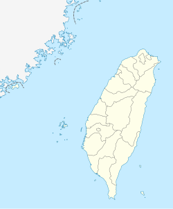
| Map | |
| Geography | |
| Location | Beinan, Taitung County, Taiwan |
| Coordinates | 22°41′32.9″N 120°59′23.0″E / 22.692472°N 120.989722°E |
| Elevation | 125-650 meters |
| Area | 110 hectares |

Jhihben National Forest Recreation Area (Chinese: 知本國家森林遊樂區; pinyin: Zhīběn Guójiā Sēnlín Yóulè Qū) is located in Beinan Township, Taitung County, Taiwan.[1]
Geography
The forest recreation area spans around 110 hectares in area with an elevation of 125 to 650 meters above sea level. The park has an annual mean temperature of around 22 °C.
Features
- Forest Bath Trail
- Hero Hill Trail
- Ficus Shade Trail
Transportation
The recreation area is accessible by bus from Taitung City.[2]
See also
References
- ^ "Jhihben National Forest Recreation Area". Recreation.forest.gov.tw. Archived from the original on 2014-06-07. Retrieved 2014-05-15.
- ^ "Jhihben National Forest Recreation Area". Recreation.forest.gov.tw. Archived from the original on 2014-05-17. Retrieved 2014-05-15.
External links
Wikimedia Commons has media related to Jhihben National Forest Recreation Area.
- 知本國家森林遊樂區 (in Chinese)

