
Nižná Polianka
Nižná Polianka | |
|---|---|
Municipality | |
 Nižná Polianka from the route to border with Poland | |
 Nižná Polianka Location of Nižná Polianka in the Prešov Region  Nižná Polianka Location of Nižná Polianka in Slovakia | |
| Coordinates: 49°24′N 21°24′E / 49.400°N 21.400°E | |
| Country | |
| Region | Prešov |
| District | Bardejov |
| First mentioned | 1435 |
| Area | |
| • Total | 5.876 km2 (2.269 sq mi) |
| Elevation | 395 m (1,296 ft) |
| Population | |
| • Total | 252 |
| • Density | 43/km2 (110/sq mi) |
| Time zone | UTC+1 (CET) |
| • Summer (DST) | UTC+2 (CEST) |
| Postal code | 086 36 |
| Area code | +421 (0)54 |
| Car plate | BJ |
| Website | www |
Nižná Polianka (Hungarian: Alsópagony) is a village and municipality in Bardejov District in the Prešov Region of north-east Slovakia.
History
In historical records the village was first mentioned in 1435
Geography
The municipality lies at an altitude of 395 metres and covers an area of 5.876 km². It has a population of about 252 people.
Media (foto, audio, documents)
-
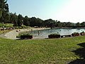 swimming pool
 -
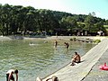 swimming pool
 -
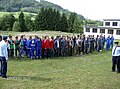 hasičská súťaž
 -
 hasičská súťaž
 -
 hasičská súťaž


External links
 Media related to Nižná Polianka at Wikimedia Commons
- Official website

- https://web.archive.org/web/20070513023228/http://www.statistics.sk/mosmis/eng/run.html
- sk:Nižná Polianka
This Prešov Region geography article is a stub. You can help Wikipedia by expanding it. |