Red Sucker Lake, Manitoba
Appearance

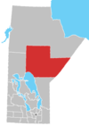
Red Sucker Lake is a designated place in northeast Manitoba, Canada adjacent to the Red Sucker Lake 1976 Indian Reserve, which is part of the Red Sucker Lake First Nation. It is located approximately 532 km (331 mi) southeast of Thompson.
Demographics
In the 2011 Census, the Red Sucker Lake designated place had a population of 23 living in 7 of its 7 total private dwellings.[1]
References
- ^ "Corrections and updates: Population and dwelling count amendments, 2011 Census". Statistics Canada. February 14, 2013. Retrieved February 16, 2013.

