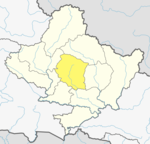
Chapakot, Kaski
Chapakot
चापाकोट | |
|---|---|
| Country | |
| Zone | Gandaki Zone |
| District | Kaski District |
| Population (1991) | |
| • Total | 2,966 |
| Time zone | UTC+5:45 (Nepal Time) |
| Postal code | 33709 |
| Area code | 061 |
Chapakot is a village and Village Development Committee in Kaski District in the Gandaki Zone of northern-central Nepal. At the time of the 1991 Nepal census it had a population of 2,966 persons residing in 574 individual households.[1]
References
- ^ "Nepal Census 2001". Nepal's Village Development Committees. Digital Himalaya. Archived from the original on October 12, 2008. Retrieved September 30, 2008.
External links
[chapakot village]
28°13′N 83°54′E / 28.217°N 83.900°E

