Gʻuzor
Appearance
Gʻuzor
Gʻuzor / Ғузoр | |
|---|---|
Town | |
 | |
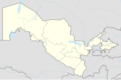
| Coordinates: 38°37′15″N 66°14′53″E / 38.62083°N 66.24806°E | |
| Country | |
| Regione | Qashqadaryo Region |
| District | Guzar District |
| Population (2005) | |
| • Total | 22,700[1] |

Gʻuzor also spelled as Guzar (Uzbek: Gʻuzor / Ғузoр; Russian: Гузар; Tajik: Гузор; Persian: گذار) is a town in Qashqadaryo Region of Uzbekistan. It serves as the administrative center of Guzar District. The town's population in 2005 was 22,700.[2]
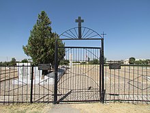
The town is home to a Polish War cemetery, one of many along the route that General Anders' army took during the Second World War. Polish War Cemetery in Guzar.


