Cope, Colorado
Cope, Colorado | |
|---|---|
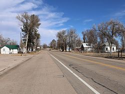
 U.S. Route 36 in Cope. | |
Location of the Cope CDP in the State of Colorado. | |
| Coordinates: 39°40′09″N 102°51′00″W / 39.6692216°N 102.8501063°W[1] | |
| Country | |
| State | |
| County | Washington County |
| Government | |
| • Type | unincorporated town |
| Area | |
| • Total | 1.827 sq mi (4.731 km2) |
| • Land | 1.796 sq mi (4.651 km2) |
| • Water | 0.031 sq mi (0.080 km2) |
| Elevation | 4,429 ft (1,350 m) |
| Time zone | UTC-7 (MST) |
| • Summer (DST) | UTC-6 (MDT) |
| ZIP Code[3] | 80812 |
| Area code | 970 |
| GNIS feature[2] | Cope CDP |
Cope is an unincorporated town, a post office, and a census-designated place (CDP) located in southeastern Washington County, Colorado, United States. The Cope post office has the ZIP Code 80812.[3] At the United States Census 2010, the population of the 80812 ZIP Code Tabulation Area was 275 including adjacent areas.[4] Washington County governs the unincorporated town.
History
The Cope post office has been in operation since 1889.[5] The community was named after Johnathon C. Cope, a railroad official.[6]
Geography
The Cope CDP has an area of 1,169 acres (4.731 km2), including 20 acres (0.080 km2) of water.[1]
Demographics
The United States Census Bureau defined the Cope CDP for the United States Census 2020.
| Year | Pop. | ±% |
|---|---|---|
| 2020 | — | |
| Source: United States Census Bureau | ||
See also
References
- ^ a b c "State of Colorado Census Designated Places - BAS20 - Data as of January 1, 2020". United States Census Bureau. Retrieved December 27, 2020.
- ^ a b c "U.S. Board on Geographic Names: Domestic Names". United States Geological Survey. Retrieved December 27, 2020.
- ^ a b "Look Up a ZIP Code". United States Postal Service. Retrieved December 27, 2020.
- ^ "2010: DEC Summary File 1". United States Census Bureau. Retrieved December 27, 2020.
- ^ "Post offices". Jim Forte Postal History. Archived from the original on 6 March 2016. Retrieved 25 June 2016.
- ^ Dawson, John Frank. Place names in Colorado: why 700 communities were so named, 150 of Spanish or Indian origin. Denver, CO: The J. Frank Dawson Publishing Co. p. 15.


