Tafraout
Appearance
Tafraout
Tafrawt / ⵜⴰⴼⵔⴰⵡⵜ تافراوت | |
|---|---|
Town | |
 | |
| Coordinates: 29°43′N 8°58′W / 29.717°N 8.967°W | |
| Country | |
| Region | Souss-Massa |
| Province | Tiznit Province |
| Population (2004) | |
• Total | 4,931 |
| Time zone | UTC+0 (WET) |
| • Summer (DST) | UTC+1 (WEST) |
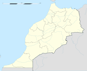
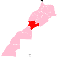
Tafraout (Template:Lang-ar, Shilha Template:Lang-ber) is a town in Tiznit Province, Souss-Massa region, Morocco, in the central part of the Anti-Atlas mountains. It had a population of 4,931 at the 2004 census.[1]
Name and etymology
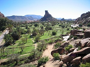
The basic meaning of the Shilha feminine noun tafrawt is "basin or cistern in which water drawn from a well is poured", with a derived meaning "valley".[2] The centre of the town of Tafraout is actually situated in a small valley, at the foot of Djebel Lekest, a pink granite mountain formed by erosion.[3] A male inhabitant is called in Shilha "u Tfrawt", (plural "ayt Tfrawt"); a female inhabitant is "ult Tfrawt", (plural "ist Tfrawt").[4]
See also
Notes
- ^ "World Gazetteer". Archived from the original on 2013-01-05.
- ^ See Laoust (1936:123) "bassin ; citerne où s'accumule l'eau tirée d'un puits ou amenée d'une source"; Destaing (1938:288) "vallée".
- ^ Scheffel, Richard L.; Wernet, Susan J., eds. (1980). Natural Wonders of the World. United States of America: Reader's Digest Association, Inc. p. 364. ISBN 0-89577-087-3.
- ^ Tfrawt is the annexed state of the noun Tafrawt; see the article Shilha language, section Prefixed nouns.
References
- Destaing, E. (1938). Etude sur la tachelḥît du Soûs. Vocabulaire français-berbère. Paris: Leroux.
- Laoust, E. (1936). Cours de berbère marocain. Dialectes du Sous du Haut et de l'Anti-Atlas. Deuxième édition revue et corrigée. Paris: Société d'éditions géographiques, maritimes et coloniales (first ed. Paris: Challamel, 1921).
External links
 Media related to Tafraout (Morocco) at Wikimedia Commons


