Los Tres Picachos
Appearance
| Tres Picachos | |
|---|---|
| Highest point | |
| Elevation | 1,205 m (3,953 ft) |
| Coordinates | 18°12′53″N 66°32′29″W / 18.21472°N 66.54139°W |
| Naming | |
| English translation | Three Peaks |
| Language of name | Spanish |
| Geography | |
| Location | Ciales / Jayuya, Puerto Rico |
| Parent range | Cordillera Central |
| Climbing | |
| Easiest route | Hike |
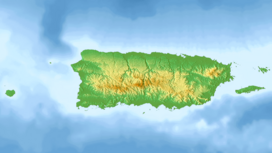
Tres Picachos (English: The Three Peaks) is one of the highest peaks in Puerto Rico at 1,205 meters (3,953 ft). It is located on the border between the municipalities of Ciales and Jayuya[1] in the central part of the island, and is part of the Cordillera Central.[2]
The mountain has three joint peaks from which the name is derived. It is believed that Taíno Indians thought the mountain to be sacred.
References
- ^ US Geological Survey
- ^ "Bosque Estatal Los Tres Picachos" (PDF). drna.pr.gov/. Estado Libre Asociado de Puerto Rico Departamento de Recursos Naturales y Ambientales. Retrieved 24 August 2020.

