Výsluní
Appearance
Výsluní | |
|---|---|
Town | |
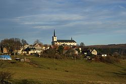
 General view of the town | |
| Coordinates: 50°28′0″N 13°14′15″E / 50.46667°N 13.23750°E | |
| Country | |
| Region | Ústí nad Labem |
| District | Chomutov |
| First mentioned | 1547 |
| Area | |
| • Total | 30.33 km2 (11.71 sq mi) |
| Elevation | 750 m (2,460 ft) |
| Population (2020-01-01[1]) | |
| • Total | 393 |
| • Density | 13/km2 (34/sq mi) |
| Time zone | UTC+1 (CET) |
| • Summer (DST) | UTC+2 (CEST) |
| Postal code | 431 83 |
| Website | www |
Výsluní, earlier also Suniperk (German: Sonnenberg) is a small town in the Ústí nad Labem Region of the Czech Republic. It has about 400 inhabitants.
Location
The city is located in northern Bohemia , nine kilometers south of the Reitzenhain border crossing on the ridge of the Ore Mountains . The city is known for the largest church in the Upper Ore Mountains, popularly known as the Ore Mountains Cathedral , which dominates the town and is visible on the southern slope of the mountains far into the North Bohemian Basin .
The Brandbächel flows through the city to the east, which then turns to Kadaň ( Kaaden ) to fall into the Eger .
References
- ^ "Population of Municipalities – 1 January 2020". Czech Statistical Office. 2020-04-30.
External links
Wikimedia Commons has media related to Výsluní.


