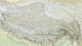
Labuche Kang III/East
Appearance
| Labuche Kang III | |
|---|---|
| Highest point | |
| Elevation | 7,250 m (23,790 ft)[1] Ranked 93rd |
| Prominence | 570 m (1,870 ft)[1] |
| Coordinates | Autonomous Region 28°18′05″N 86°23′02″E / 28.30139°N 86.38389°E[1] |
| Geography | |
| Location | Tibet Autonomous Region, China |
| Parent range | Himalaya |
| Climbing | |
| First ascent | Unclimbed |
| Easiest route | Technical |
Labuche Kang III, also known as Labuche Kang East (7,250 metres (23,790 ft)), is a mountain located on the Labuche Kang massif in Tibet Autonomous Region and is one of the highest unclimbed mountains in the world after Gangkhar Puensum.[2] The former second highest unclimbed mountain, Saser Kangri II East was first climbed on August 24, 2011.[3]
See also
References
- ^ a b c "Labuche Kang III, China". Peakbagger.com. Retrieved March 14, 2018.
- ^ Nuwer, Rachel (4 July 2014). "The mountains we have never climbed". BBC. Retrieved 14 February 2018.
- ^ Maynard, Emily (September 15, 2011). "Saser Kangri II In Alpine Style". The Alpinist. Retrieved March 14, 2018.


