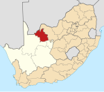
Dibeng
Dibeng | |
|---|---|
| Coordinates: 27°35′00″S 22°53′00″E / 27.583333°S 22.883333°E | |
| Country | South Africa |
| Province | Northern Cape |
| District | John Taolo Gaetsewe |
| Municipality | Gamagara |
| Area | |
| • Total | 9.08 km2 (3.51 sq mi) |
| Population (2011)[1] | |
| • Total | 7,848 |
| • Density | 860/km2 (2,200/sq mi) |
| Racial makeup (2011) | |
| • Black African | 62.2% |
| • Coloured | 30.0% |
| • Indian/Asian | 0.5% |
| • White | 6.5% |
| • Other | 0.9% |
| First languages (2011) | |
| • Tswana | 48.5% |
| • Afrikaans | 46.1% |
| • English | 1.4% |
| • Zulu | 1.0% |
| • Other | 2.9% |
| Time zone | UTC+2 (SAST) |
| Postal code (street) | 8463 |
| PO box | 8463 |
| Area code | 053 |
Dibeng is a town in John Taolo Gaetsewe District Municipality in the Northern Cape province of South Africa, situated on the banks of the dry Gamagara River.[2] The name is Tswana in origin, from deben, and means "first drinking place".[3] Deben is a variant spelling.[4]
See also
References


