Flaçà
Flaçà | |
|---|---|
 Flaçà old town with St. Cebrià church | |
| Coordinates: 42°3′2″N 2°57′20″E / 42.05056°N 2.95556°E | |
| Country | |
| Community | |
| Province | |
| Comarca | Gironès |
| Government | |
| • Mayor | Jesús Font Galí (2015)[1] |
| Area | |
| • Total | 6.5 km2 (2.5 sq mi) |
| Population (2018)[3] | |
| • Total | 1,081 |
| • Density | 170/km2 (430/sq mi) |
| Website | www |
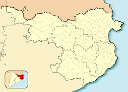
Flaçà is a town in the Gironès county of Girona Province, Catalonia, Spain. It occupies an area of 6.67 square kilometers and extends the hills of the Lloreda Valley and alluvial plain of the Ter river. It borders the Ter River to the north and the municipality of Sant Jordi Desvalls to the west with the municipalities of Sant Joan de Mollet Sant Marti Vell to the south and to east, the towns of Foixà and la Pera. The current population is 1,070 people.
References
- ^ "Ajuntament de Flaçà". Generalitat of Catalonia. Retrieved 2015-11-13.
- ^ "El municipi en xifres: Flaçà". Statistical Institute of Catalonia. Retrieved 2015-11-23.
- ^ Municipal Register of Spain 2018. National Statistics Institute.
External links
- Government data pages (in Catalan)


