Gerli
Gerli | |
|---|---|
Town | |
|
Coat of arms of Gerli Coat of arms | |
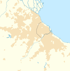
Location in Greater Buenos Aires | |
| Coordinates: 34°41′S 58°22′W / 34.683°S 58.367°W | |
| Country | |
| Province | |
| Partido | Avellaneda & Lanús |
| Founded | March 30, 1909 |
| Elevation | 6 m (20 ft) |
| Population | |
| • Total | 64,640 |
| • Density | 9,151/km2 (23,700/sq mi) |
| CPA Base | B 1870 |
| Area code | +54 11 |
Gerli is a town in Buenos Aires Province, Argentina. It lies in the partidos of Avellaneda and Lanús and forms part of the Greater Buenos Aires urban agglomeration.
History
- 30 March 1909: The settlement was officially established on territory owned by Antonio Gerli.
- 1944: Gerli was divided by the creation of the Lanús Partido.
- 11 November 2005: Gerli was officially declared a municipality by the Legislature of Buenos Aires Province.
Population
Gerli had a population of 64,640 inhabitants 2001 census [INDEC], 31,090 in Avellaneda and 33,250 in Lanús.
Sport
The town is home to Club El Porvenir a football club who play in the lower leagues of Argentine football.
Neighbourhoods
|
|
External links
Wikimedia Commons has media related to Gerli.
- Municipal information: Municipal Affairs Federal Institute (IFAM), Municipal Affairs Secretariat, Ministry of Interior, Argentina. (in Spanish)
- Municipal website (in Spanish)


