
Ubbergen
Ubbergen | |
|---|---|
Town and former municipality | |
 Church in Beek | |
 Flag  Coat of arms | |
.svg) Location in Gelderland | |
| Coordinates: 51°50′N 5°55′E / 51.833°N 5.917°E | |
| Country | Netherlands |
| Province | Gelderland |
| Municipality | Berg en Dal |
| Area | |
| • Total | 38.88 km2 (15.01 sq mi) |
| • Land | 33.77 km2 (13.04 sq mi) |
| • Water | 5.11 km2 (1.97 sq mi) |
| Elevation | 13 m (43 ft) |
| Population (January 2021)[3] | |
| • Total | data missing |
| Demonym | Ubberger |
| Time zone | UTC+1 (CET) |
| • Summer (DST) | UTC+2 (CEST) |
| Postcode | 6570–6579 |
| Area code | 024 |
| Website | www |
Ubbergen (ⓘ) is a former municipality and a town in the eastern Netherlands, in the municipality of Berg en Dal (formerly known as Groesbeek).
Gallery
-
 Ubbergen, monastery: complex de Refter
 -
 Kekerdom, church
 -
 Persingen, church
 -
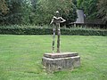 Statue of Nescio


References
- ^ "Kerncijfers wijken en buurten 2020" [Key figures for neighbourhoods 2020]. StatLine (in Dutch). CBS. 24 July 2020. Retrieved 19 September 2020.
- ^ "Postcodetool for 6573CL". Actueel Hoogtebestand Nederland (in Dutch). Het Waterschapshuis. Retrieved 18 July 2014.
- ^ "Bevolkingsontwikkeling; regio per maand" [Population growth; regions per month]. CBS Statline (in Dutch). CBS. 1 January 2021. Retrieved 2 January 2022.
External links
 Media related to Ubbergen at Wikimedia Commons
- Official website
This Gelderland location article is a stub. You can help Wikipedia by expanding it. |