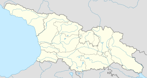
Abari
Abari
აბარი | |
|---|---|
| Coordinates: 42°37′7″N 43°15′41″E / 42.61861°N 43.26139°E | |
| Country | |
| Region | Racha-Lechkhumi and Kvemo Svaneti |
| Municipality | Ambrolauri |
| Elevation | 880 m (2,890 ft) |
| Population (2002) | |
| • Total | 206 |
Abari (Georgian: აბარი) is a village in Racha-Lechkhumi and Kvemo Svaneti region, Georgia. It is part of the Likheti commune, Ambrolauri municipality, with the population of 206, mostly (99%) ethnic Georgians, as of the 2002 census.[1][2]
Abari is located on the right bank of the Lukhuni river, a right tributary of the Rioni, on the southern foothills of the Lechkhumi range, 17 km. northeast of the town of Ambrolauri.
The population of Abari is dominated by two surnames: Lobzhanidze and Japaridze.[3] According to local tradition, the village was founded by a man surnamed Lobzhanidze from the Ghebi in the northernmost part of Racha in the 18th century.[4] The Japaridze descend from a priest sent to Abari in the 19th century.[3] Since the Soviet period, the families in Abari have used rural-urban migration to access the different resources provided by the village and the city.[5]
References
- ^ Template:Ka icon საქართველოს მოსახლეობის 2002 წლის პირველი ეროვნული საყოველთაო აღწერის ძირითადი შედეგები, ტ. II: საქართველოს სოფლების მოსახლეობა Archived 2013-08-27 at the Wayback Machine ("The results of the 2002 population census of Georgia, vol. 2: The population of villages of Georgia"). National Statistics Office, 2003. Retrieved June 23, 2012.
- ^ 2002 Georgia census data Archived 2012-04-19 at the Wayback Machine. Population statistics of Eastern Europe. Retrieved June 23, 2012.
- ^ a b Dragadze 1988, p. 4
- ^ Dragadze 1988, p. 3
- ^ Dragadze 1988, pp. 53–56
Sources
- Dragadze, Tamara (1988). Rural Families in Soviet Georgia: A Case Study in Ratcha. London: Routledge. ISBN 978-0-415-00619-4.
{{cite book}}: Invalid|ref=harv(help)

