Abreus, Cuba
Appearance
Parts of this article (those related to population) need to be updated. (September 2017) |
Abreus | |
|---|---|
 Abreus municipality (red) within Cienfuegos Province (yellow) and Cuba | |
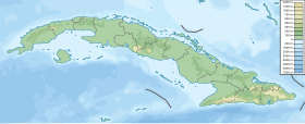
Location of Abreus in Cuba | |
| Coordinates: 22°16′50″N 80°34′4″W / 22.28056°N 80.56778°W | |
| Country | |
| Province | Cienfuegos |
| Founded | 1840[1] |
| Area | |
| • Total | 564 km2 (218 sq mi) |
| Elevation | 60 m (200 ft) |
| Population (2004)[3] | |
| • Total | 30,330 |
| • Density | 53.8/km2 (139/sq mi) |
| Time zone | UTC-5 (EST) |
| Area code | +53-432 |
Abreus (Spanish pronunciation: [aˈβɾeus]) is a municipality and town in the Cienfuegos Province of Cuba. It was founded in 1840.[1]
Geography
The municipality iincludes the town of Abreus[1] and the villages of Babiney, Carmelina, Cayo Grande, Charcas, Cienguita, Constancia, Horquitas, Juraguá, Matun, Mijailito, Navarra, Nueva Juraguá, San Ignacio, Simpatía and Yaguaramas.[4] It is bordered by Ciénaga de Zapata and Calimete, both in Matanzas Province, and by Aguada de Pasajeros, Rodas and Cienfuegos.
Demographics
In 2004, the municipality of Abreus had a population of 30,330.[3] With a total area of 564 km2 (218 sq mi),[2] it has a population density of 53.8/km2 (139/sq mi).
Notable natives
- Yoan Moncada (born 1995) - Professional baseball player for the Chicago White Sox.
See also
References
- ^ a b c Guije.com. "Abreus" (in Spanish). Archived from the original on 12 October 2007. Retrieved 7 October 2007.
{{cite web}}: Unknown parameter|deadurl=ignored (|url-status=suggested) (help) - ^ a b Statoids (July 2003). "Municipios of Cuba". Archived from the original on 12 October 2007. Retrieved 7 October 2007.
{{cite web}}: Unknown parameter|deadurl=ignored (|url-status=suggested) (help) - ^ a b Atenas.cu (2004). "2004 Population trends, by Province and Municipality" (in Spanish). Archived from the original on 14 July 2006. Retrieved 7 October 2007.
{{cite web}}: Unknown parameter|dead-url=ignored (|url-status=suggested) (help) - ^ Template:Es icon Yaguaramas on EcuRed
External links
Wikimedia Commons has media related to Abreus.

