Argelos, Landes
Argelos | |
|---|---|
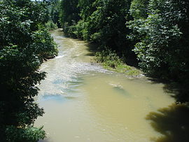
 The Luy de France between Momuy and Argelos | |
| Coordinates: 43°35′01″N 0°37′41″W / 43.5836°N 0.6281°W | |
| Country | France |
| Region | Nouvelle-Aquitaine |
| Department | Landes |
| Arrondissement | Dax |
| Canton | Coteau de Chalosse |
| Intercommunality | CC Coteaux Vallées Luys |
| Government | |
| • Mayor (2014-2020) | Fabienne Lassalle |
| Area 1 | 6.44 km2 (2.49 sq mi) |
| Population (2015) | 166 |
| • Density | 26/km2 (67/sq mi) |
| Time zone | UTC+01:00 (CET) |
| • Summer (DST) | UTC+02:00 (CEST) |
| INSEE/Postal code | 40007 /40700 |
| Elevation | 48–157 m (157–515 ft) |
| 1 French Land Register data, which excludes lakes, ponds, glaciers > 1 km2 (0.386 sq mi or 247 acres) and river estuaries. | |
Argelos (Argelòs in Occitan) is a commune of the Landes department in Nouvelle-Aquitaine in southwestern France.
Population
| Year | Pop. | ±% |
|---|---|---|
| 1962 | 235 | — |
| 1968 | 216 | −8.1% |
| 1975 | 178 | −17.6% |
| 1982 | 159 | −10.7% |
| 1990 | 181 | +13.8% |
| 1999 | 173 | −4.4% |
| 2006 | 169 | −2.3% |
| 2009 | 180 | +6.5% |
| 2015 | 166 | −7.8% |
See also
References
Wikimedia Commons has media related to Argelos (Landes).


