Bükkábrány
Bükkábrány | |
|---|---|
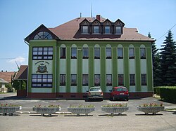
 City Hall of Bükkábrány | |
| Coordinates: 47°53′18″N 20°40′45″E / 47.88840°N 20.67927°E | |
| Country | |
| County | Borsod-Abaúj-Zemplén |
| Area | |
| • Total | 18.02 km2 (6.96 sq mi) |
| Population (2004) | |
| • Total | 1,693 |
| • Density | 93.95/km2 (243.3/sq mi) |
| Time zone | UTC+1 (CET) |
| • Summer (DST) | UTC+2 (CEST) |
| Postal code | 3422 |
| Area code | 49 |
Bükkábrány is a village in Borsod-Abaúj-Zemplén county, Hungary. In its open cast coal mine palaeontologist found sixteen preserved trunks of cypress trees, estimated to be eight million years old. See 8 million years old cypresses.


