
Bangalee, Queensland (Gladstone Region)
This article needs additional citations for verification. (December 2017) |
| Bangalee Queensland | |
|---|---|
 Bangalee | |
| Coordinates | 24°00′S 151°26′E / 24.000°S 151.433°E |
| Postcode(s) | 4680 |
| Location | 515 km (320 mi) N of Brisbane |
| LGA(s) | Gladstone Region |
| State electorate(s) | Gladstone |
| Federal division(s) | Flynn |
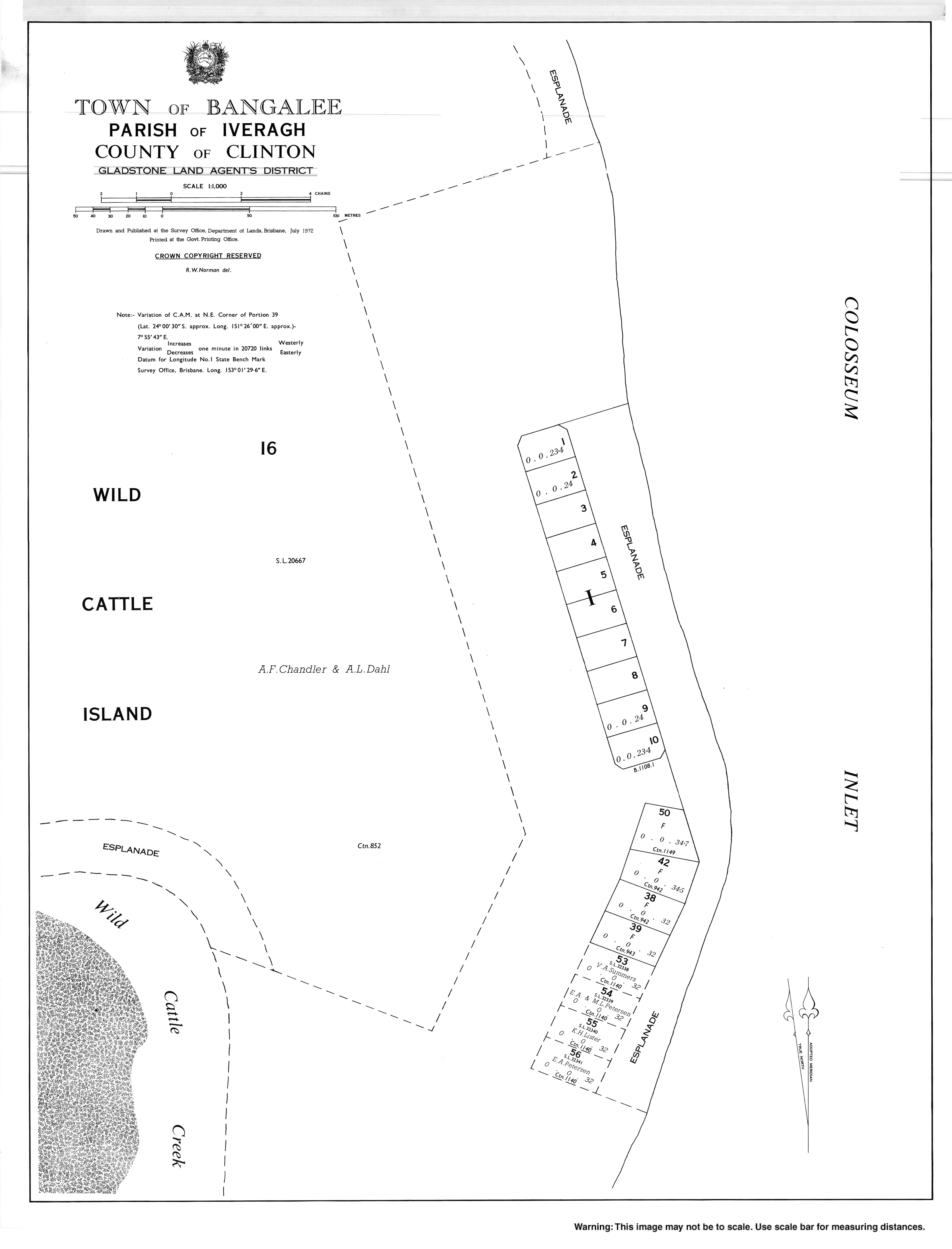
Bangalee is a beachside town in the locality of Tannum Sands, Gladstone Region, Queensland, Australia.[1]
Geography
Bangalee is on the south eastern tip of Wild Cattle Island.
It consists of about 16 parcels of residential land on which most have houses or shacks that are used for recreational purposes and are generally not principal places of residences.
Access to the settlement is via boat or 4WD vehicle for those with an interest in an estate and a permit from Gladstone Regional Council across and along Wild Cattle Island National Park.
References
- ^ "Bangalee – town in Gladstone Region (entry 1509)". Queensland Place Names. Queensland Government. Retrieved 21 June 2017.
External links
This Queensland location article is a stub. You can help Wikipedia by expanding it. |