Bangru (village)
Bangru
崩日村 | |
|---|---|
Village | |
| Country | People's Republic of China |
| Autonomous Region | Tibet |
| Prefecture-level city | Chamdo |
| County | Riwoqê County |
| Township | Yiri (伊日乡) |
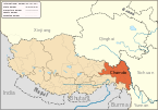
Bangru (Chinese: 崩日; Pinyin: Bēngrì) is a village (村) in Riwoqê County, Tibet Autonomous Region of China.[1][2] It lies at an altitude of 4,782 metres (15,692 feet).
31°46′N 97°17′E / 31.767°N 97.283°E
See also
Notes
- ^ Template:Zh iconWu Zhenhua (武振华), Xizang Diming (西藏地名; Place Names in Tibet), p.40, Chinese Zangxue Press (中国藏学出版社) 1996, ISBN 7-80057-284-6
- ^ 2017年统计用区划代码和城乡划分代码:伊日乡 [2017 Statistical Area Numbers and Rural-Urban Area Numbers: Yiri Township] (in Simplified Chinese). National Bureau of Statistics of the People's Republic of China. 2017. Retrieved 25 July 2018.
540323205205 220 崩日村村委会
{{cite web}}: Cite has empty unknown parameter:|1=(help)

