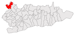
Belciugatele
Appearance
Belciugatele | |
|---|---|
 Location of Belciugatele | |
| Country | |
| County | Călărași County |
| Area | |
| • Total | 80.14 km2 (30.94 sq mi) |
| Population (2007) | |
| • Total | 1,878 |
| Time zone | UTC+2 (EET) |
| • Summer (DST) | UTC+3 (EEST) |
Belciugatele is a commune in Călărași County, Romania. It is composed of five villages: Belciugatele, Cândeasca, Cojești, Mataraua and Măriuța.
As of 2007 the population of Belciugatele is 1,878.
44°29′N 26°26′E / 44.483°N 26.433°E

