Black Hills Airport
Appearance
Black Hills Airport Clyde Ice Field | |||||||||||||||||||
|---|---|---|---|---|---|---|---|---|---|---|---|---|---|---|---|---|---|---|---|
| Summary | |||||||||||||||||||
| Airport type | Public | ||||||||||||||||||
| Owner | Lawrence County Airport Board | ||||||||||||||||||
| Location | Spearfish, South Dakota | ||||||||||||||||||
| Elevation AMSL | 3,933 ft / 1,199 m | ||||||||||||||||||
| Coordinates | 44°28′49″N 103°46′59″W / 44.48028°N 103.78306°W | ||||||||||||||||||
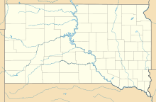
| Map | |||||||||||||||||||
 | |||||||||||||||||||
| Runways | |||||||||||||||||||
| |||||||||||||||||||
| Statistics (2022) | |||||||||||||||||||
| |||||||||||||||||||
Black Hills Airport[2] (IATA: SPF, ICAO: KSPF, FAA LID: SPF) (Clyde Ice Field) is a public airport three miles (5 km) east of Spearfish, in Lawrence County, South Dakota.[1]
Western Airlines served Spearfish from 1949-50 until 1959.
Facilities
[edit]The airport covers 485 acres (196 ha); its paved runway, 13/31, is 6,401 x 75 ft (1,951 x 23 m) asphalt. It has two grass runways: 8/26 is 4,003 x 100 ft (1,220 x 30 m), and 4/22 is 1,995 x 120 ft (608 x 37 m).[1]
In the year ending May 11, 2022 the airport had 17,000 aircraft operations, average 47 per day: 89% general aviation, 7% air taxi and 5% military. 71 aircraft were then based at this airport: 65 single-engine, 4 multi-engine, 1 helicopter, and 1 glider.[1]
See also
[edit]References
[edit]- ^ a b c d FAA Airport Form 5010 for SPF PDF, effective 2023-09-07
- ^ Lawrence County Airport Board Archived February 21, 2009, at the Wayback Machine. "Black Hills Airport".
External links
[edit]- Lawrence County Airport Board - Black Hills Airport
- FAA Terminal Procedures for SPF, effective October 3, 2024
- Resources for this airport:
- FAA airport information for SPF
- AirNav airport information for SPF
- ASN accident history for SPF
- FlightAware airport information and live flight tracker
- SkyVector aeronautical chart for SPF


