
Brewster, Nebraska
Brewster, Nebraska | |
|---|---|
 Location of Brewster, Nebraska | |
| Country | United States |
| State | Nebraska |
| County | Blaine |
| Area | |
| • Total | 0.1 sq mi (0.2 km2) |
| • Land | 0.1 sq mi (0.2 km2) |
| • Water | 0.0 sq mi (0.0 km2) |
| Elevation | 2,493 ft (760 m) |
| Population (2000) | |
| • Total | 29 |
| • Density | 333.8/sq mi (128.9/km2) |
| Time zone | UTC-6 (Central (CST)) |
| • Summer (DST) | UTC-5 (CDT) |
| ZIP code | 68821 |
| Area code | 308 |
| FIPS code | 31-06260Template:GR |
| GNIS feature ID | 0827637Template:GR |
Brewster is a village in Blaine County, Nebraska, United States. The population was 29 at the 2000 census. It is the county seat of Blaine CountyTemplate:GR.
Geography
Brewster is located at 41°56′18″N 99°51′56″W / 41.93833°N 99.86556°W (41.938374, -99.865492)Template:GR.
According to the United States Census Bureau, the village has a total area of 0.1 square miles (0.2 km²), all of it land.
Demographics
As of the censusTemplate:GR of 2000, there were 29 people, 12 households, and 9 families residing in the village. The population density was 333.8 people per square mile (124.4/km²). There were 20 housing units at an average density of 230.2/sq mi (85.8/km²). The racial makeup of the village was 100.00% White.
There were 12 households out of which 16.7% had children under the age of 18 living with them, 75.0% were married couples living together, and 16.7% were non-families. 16.7% of all households were made up of individuals and 8.3% had someone living alone who was 65 years of age or older. The average household size was 2.42 and the average family size was 2.70.
In the village the population was spread out with 24.1% under the age of 18, 6.9% from 18 to 24, 20.7% from 25 to 44, 37.9% from 45 to 64, and 10.3% who were 65 years of age or older. The median age was 42 years. For every 100 females there were 81.3 males. For every 100 females age 18 and over, there were 100.0 males.
The median income for a household in the village was $37,500, and the median income for a family was $51,250. Males had a median income of $26,250 versus $28,750 for females. The per capita income for the village was $12,840. There were 33.3% of families and 20.0% of the population living below the poverty line, including no under eighteens and none of those over 64.
Notable native
- Milly Bernard - Member of the Utah House of Representatives from 1966 to 1976.
References
External links
Municipalities and communities of Blaine County, Nebraska, United States | ||
|---|---|---|
| Villages | 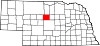 | |
| Unincorporated communities | ||
| Footnotes | ‡This populated place also has portions in an adjacent county or counties | |