
Burg (Spreewald)
Burg/Bórkowy | |
|---|---|
.png) Coat of arms | |
Location of Burg/Bórkowy within Spree-Neiße district 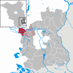 | |
 Burg/Bórkowy  Burg/Bórkowy | |
| Coordinates: 51°50′05″N 14°09′0″E / 51.83472°N 14.15000°E | |
| Country | Germany |
| State | Brandenburg |
| District | Spree-Neiße |
| Municipal assoc. | Burg (Spreewald) |
| Government | |
| • Mayor | Ira Frackmann (CDU) |
| Area | |
| • Total | 35.16 km2 (13.58 sq mi) |
| Elevation | 57 m (187 ft) |
| Population (2022-12-31)[1] | |
| • Total | 4,246 |
| • Density | 120/km2 (310/sq mi) |
| Time zone | UTC+01:00 (CET) |
| • Summer (DST) | UTC+02:00 (CEST) |
| Postal codes | 03096 |
| Dialling codes | 035603 |
| Vehicle registration | SPN, FOR, GUB, SPB |
| Website | www.amt-burg-spreewald.de |
Burg (Spreewald) (Lower Sorbian: Bórkowy (Błota)) is a municipality in the district of Spree-Neiße, in Brandenburg, Germany.
Demography

|
|
References
- ^ "Bevölkerungsentwicklung und Bevölkerungsstandim Land Brandenburg Dezember 2022" (PDF). Amt für Statistik Berlin-Brandenburg (in German). June 2023.
- ^ Detailed data sources are to be found in the Wikimedia Commons.Population Projection Brandenburg at Wikimedia Commons
| International | |
|---|---|
| National | |
| Geographic | |
This Brandenburg location article is a stub. You can help Wikipedia by expanding it. |