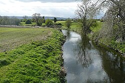
Burren River
| Burren River | |
|---|---|
 View from Ballinacarrig Bridge | |
 | |
| Etymology | rocky land |
| Native name | An Bhoirinn Error {{native name checker}}: parameter value is malformed (help) |
| Physical characteristics | |
| Source | |
| • location | north face of Mount Leinster |
| Mouth | |
• location | Celtic Sea via River Barrow |
| Length | 39 kilometres (24 mi) |
| Basin size | 154 square kilometres (59 sq mi)[1] |
| Discharge | |
| • average | 0.476 m3/s (16.8 cu ft/s)[2] |
The Burren River is a river in Ireland, flowing through County Carlow.[3][4]
Course

The Burren River rises on the north face of Mount Leinster and flows northward under the R724 (Ullard Bridge, west of Fenagh) and under the N80. It continues northward through Rathoe meeting the Aghalona River in Inchisland and turns westwards, passing under the M9 in Moyle Big. The Burren River goes under the N80 again at Ballinacarrig Bridge. It flows through the southern part of Carlow town and passes under the railway line, R448 and R417 (Burrin Street) and then drains into the River Barrow.[5][6]
Wildlife
Fish species include brown trout, three-spined stickleback, nine-spined stickleback, Atlantic salmon, stone loach, common bream, roach, perch and lamprey.[7][8]
See also
References
- ^ https://www.epa.ie/pubs/reports/water/flows/Hydrological%20Data%20Book%201995.pdf
- ^ http://www.epa.ie/licences/lic_eDMS/090151b28031dbfd.pdf
- ^ "Carlow: History & Society : Interdiscplinary Essays on the History of an Irish County". Geography Publications. 1 January 2008 – via Google Books.
- ^ Joyce, Patrick Weston; Sullivan, Alexander Martin (1 January 1902). "A Comprehensive Atlas and Cyclopedia of Ireland [and] General History". Murphy & McCarthy – via Google Books.
- ^ "Carlow".
- ^ Joyce, Patrick Weston (1 January 1883). "The geography of the counties of Ireland" – via Google Books.
- ^ http://www.wfdfish.ie/wp-content/uploads/2011/01/SERBD_rivers_report_2009.pdf
- ^ Services, Prebait Angling. "Coarse Fishing, Burren River, Carlow, Ireland. Coarse Angling, Burren River, Carlow, Ireland".
52°38′20″N 6°47′00″W / 52.639000°N 6.783363°W
