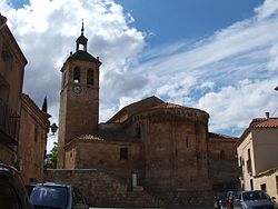
Caltojar
Appearance
Caltojar, Spain | |
|---|---|
 Aerial view of Caltojar | |
| Country | Spain |
| Autonomous community | Castile and León |
| Province | Soria |
| Municipality | Caltojar |
| Area | |
| • Total | 84.36 km2 (32.57 sq mi) |
| Elevation | 961 m (3,153 ft) |
| Population (2017) | |
| • Total | 59 |
| • Density | 0.70/km2 (1.8/sq mi) |
| Time zone | UTC+1 (CET) |
| • Summer (DST) | UTC+2 (CEST) |
Caltojar is a municipality located in the province of Soria, Castile and León, Spain. According to the 2004 census (INE), the municipality had a population of 111 inhabitants. The municipality includes the villages of Bordecorex and Casillas de Berlanga.


41°24′N 2°45′W / 41.400°N 2.750°W

