
Glen Haven, Michigan
This article needs additional citations for verification. (December 2020) |
Glen Haven, Michigan | |
|---|---|
 Looking north on the former M-209 | |
 Glen Haven Location within the state of Michigan | |
| Coordinates: 44°53′56″N 86°01′49″W / 44.89889°N 86.03028°W | |
| Country | |
| State | |
| County | |
| Township | Glen Arbor |
| Part of | Sleeping Bear Dunes National Lakeshore |
| Settled | 1857 (Sleeping Bearville) |
| Government | |
| • Type | National Park Service |
| Elevation | 598 ft (182 m) |
| Time zone | UTC-5 (EST) |
| • Summer (DST) | UTC-4 (EDT) |
| ZIP code(s) | 49630 |
| Area code | 231 |
Glen Haven Village Historic District | |
| Area | 16 acres (6.5 ha) |
| Built | 1857 |
| NRHP reference No. | 83000882 [1] |
| Added to NRHP | June 24, 1983 |
Glen Haven is a restored port village on the shore of Lake Michigan on the Leelanau Peninsula within the now Sleeping Bear Dunes National Lakeshore. Attractions include the Lake Michigan beach, a restored General Store and Blacksmith Shop. The unincorporated community is located in Glen Arbor Township.
History
[edit]Glen Haven, located on Sleeping Bear Bay, developed as a Lake Michigan deep water port to service shipping traffic with firewood, lumber and other supplies and services. In 1857, Glen Haven, was founded as a settlement called Sleeping Bearville when C. C. McCarty, brother-in-law of Glen Arbor pioneer John E. Fisher, built a saw mill and inn on the beach there.[2][3] By 1881, there were 11 buildings in the community.
Over years the timberline receded away from the shore and steamer firewood became scarce. In 1911, an agent for the Northern Transportation company, David H. Day, was sent to Glen Haven to secure and maintain a source of firewood to feed the boilers of the company's steam ships. He established a lumber mill on a pond between Little Glen Lake and the current National Park sand dune climbing area. Timber was harvested from around the inland lakes and floated to the saw mill for processing. The timber products were brought to the Glen Haven port by a narrow gauge steam locomotive on tracks along the base of sand dunes. The tracks ended on a long dock where the wood products were loaded directly onto ships. (The dock poles can still be seen off the shore)
The Sleeping Bear National Lakeshore was authorized by congress on October 21, 1970. The National Park Service (N.P.S.) acquired private properties within and outside the planned park boundary under eminent domain and condemnation court proceedings.
Also located in Glen Haven is the former Glen Haven Canning Co. building. This building was first used as a warehouse and later as a cannery for cherries in the 1920s. It has since been restored as the Cannery Boathouse Museum, housing historic small wooden boats used in the Manitou Passage between Glen Haven/Glen Arbor and the North and South Manitou Islands.[4]
The former M-209, once the shortest state highway in Michigan, extended from M-109 to Sleeping Bear Dunes Road adjacent to the canning factory. (M-209 was turned back to Leelanau County control in 1995 and is no longer a state highway, although many still refer to it by its former route designation today.) To the west along the waterfront, Sleeping Bear Dunes Rd terminates in front of the former U.S. Coast Guard Life Saving Station, now restored as the Sleeping Bear Point Coast Guard Station Maritime Museum.[5] The exhibits focus on the U.S. Life-Saving Service, the U.S. Coast Guard, and Great Lakes shipping history. In the summer, demonstrations are given of rescue drills and equipment used to fire a rescue line from shore more than 400 yards (370 m) to a ship in distress.
The Coast Guard lifesaving station was built in 1901 and moved to its present location in 1931 before closing in 1941.[6] The Park Service purchased all of the village by the mid-1970s. The last resident, Carolyn Bumgardner, was evicted through eminent domain in November 2007 after a long battle to keep her property.[7]
Sleeping Bear Dunes National Lakeshore is a United States National Lakeshore located on the "little finger" of the lower peninsula of Michigan in Leelanau and Benzie counties.
The park covers a 35-mile (56 km) stretch of Lake Michigan's eastern coastline, as well as North and South Manitou Islands. The park was established primarily for its outstanding natural features, including forests, beaches, dune formations, and ancient glacial phenomena. The Lakeshore also contains many cultural features including the 1871 South Manitou Island Lighthouse, three former Life-Saving Service/Coast Guard Stations and an extensive rural historic farm district.
Images
[edit]-
 The D.H. Day General store in Glen Haven
 -
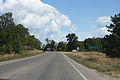 Looking north toward Glen Haven along Glen Haven Road (former M-209)
 -
 Inside the Cannery Boathouse Museum


See also
[edit]References
[edit]- ^ "National Register Information System". National Register of Historic Places. National Park Service. March 13, 2009.
- ^ "Sleeping Bear Dunes National Lakeshore - Glen Haven History and Culture". National Park Service. Retrieved February 23, 2008.
- ^ "D. H. Day". National Park Service. Retrieved February 23, 2008.
- ^ "Sleeping Bear Dunes National Lakeshore". National Park Service. Retrieved February 15, 2008.
- ^ "Sleeping Bear Dunes National Lakeshore - Maritime Museum". National Park Service. Retrieved February 15, 2008.
- ^ Weeks, George (2005). Sleeping Bear: Yesterday and Today. Ann Arbor, Michigan: University of Michigan Press. ISBN 0-472-03031-0.
- ^ "Week in Review: 11/11/2007". Traverse City Record-Eagle. November 11, 2007. Retrieved March 24, 2009.
External links
[edit]- National Park Service slideshow of Glen Haven
- Sleeping Bear Point Coast Guard Station Maritime Museum
- Cannery Boathouse Museum
- Glen Haven General Store
- Glen Haven Blacksmith Shop
- Ghost Towns in Michigan
Municipalities and communities of Leelanau County, Michigan, United States | ||
|---|---|---|
| City | 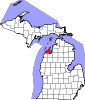 | |
| Villages | ||
| Charter township | ||
| Civil townships | ||
| CDPs | ||
| Other communities | ||
| Ghost towns | ||
| Indian reservation | ||
| Footnotes | ‡This populated place also has portions in an adjacent county or counties | |

- National Register of Historic Places in Sleeping Bear Dunes National Lakeshore
- Museums in Leelanau County, Michigan
- Open-air museums in Michigan
- Historic districts on the National Register of Historic Places in Michigan
- 1857 establishments in Michigan
- Populated places established in 1857
- Maritime museums in Michigan
- National Register of Historic Places in Leelanau County, Michigan