Cavour, Piedmont
Cavour | |
|---|---|
| Comune di Cavour | |
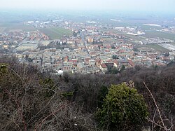
 Cavour seen from its Rocca | |
| Coordinates: 44°47′N 7°23′E / 44.783°N 7.383°E | |
| Country | Italy |
| Region | Piedmont |
| Metropolitan city | Turin (TO) |
| Frazioni | Babano, Cappella del Bosco, Castellani-Vacci, Castellazzo, Cursaglie (or Cappella Nuova), Gemerello, Malano, San Giacomo, San Michele, Sant'Agostino, Sant'Anna, Sant'Antonio, Zucchea |
| Government | |
| • Mayor | Sergio Paschetta |
| Area | |
• Total | 48.96 km2 (18.90 sq mi) |
| Elevation | 300 m (1,000 ft) |
| Population | |
• Total | 5,495 |
| • Density | 110/km2 (290/sq mi) |
| Demonym | Cavouresi |
| Time zone | UTC+1 (CET) |
| • Summer (DST) | UTC+2 (CEST) |
| Postal code | 10061 |
| Dialing code | 0121 |
| Patron saint | St. Lawrence |
| Saint day | First Sunday in August |
| Website | Official website |
Cavour (Italian pronunciation: [kaˈvur]; from the Piedmontese toponym, Cavor [kaˈʋʊr]; Latin: Caburrum) is a comune (municipality) in the Metropolitan City of Turin in the Italian region Piedmont, located about 40 kilometres (25 mi) southwest of Turin.
Cavour borders the following municipalities: Macello, Vigone, Bricherasio, Garzigliana, Villafranca Piemonte, Campiglione-Fenile, Bibiana, Bagnolo Piemonte, Barge.
History
[edit]
Its ancient Roman name was Caburrum or Forum Vibii. Cavour lies on the north side of a huge isolated mass of granite (the Rocca di Cavour) which rises from the plain. On the summit was the Roman village, which belonged to the province of the Alpes Cottiae. There are some ruins of medieval fortifications.
In 1422 Cavour was captured by Thomas of Savoy and passed into Savoyard hands until in 1433 the castle and its lordship was bestowed by Amadeus VIII to Louis of Achaea[4] [5],the illegitimate son of Louis of Piedmont and his descendants the lords of Raconis.(Racconigi)
The area around was a stronghold of the Christian movement of the Waldensians who were persecuted for their faith, culminating in Emanuele Filiberto of Savoy engaging the Waldensians in battle; the attack was repelled through guerrilla warfare. The duke was then forced to give the Waldensians a limited right to exercise their religion, recorded in the Treaty of Cavour (1561)[6]
Starting in 1592 and for several years during the French Wars of Religion the town was occupied by François de Bonne, Duke of Lesdiguières[6] and thus controlling the movements in the area.
The town gave its name to the Benso family of Chieri, who were raised to the marquisate in 1771, and of which the statesman Cavour was a member.[7]
People
[edit]References
[edit]- ^ "Superficie di Comuni Province e Regioni italiane al 9 ottobre 2011". Italian National Institute of Statistics. Retrieved 16 March 2019.
- ^ All demographics and other statistics: Italian statistical institute Istat.
- ^ "Popolazione Residente al 1° Gennaio 2018". Italian National Institute of Statistics. Retrieved 16 March 2019.
- ^ Neu-vermehrtes Historisch- und Geographisches Allgemeines Lexicon (in German). Johann Brandmüller (published 1724). 1729. p. 734.
- ^ Barthélemy, Edouard de (1860). Les princes de la maison royale de Savoie (in French). Poulet-Malassis et de Broise.
- ^ a b Visconti, Joseph (September 2003). The Waldensian Way to God. Xulon Press. ISBN 978-1-59160-792-2.
- ^ One or more of the preceding sentences incorporates text from a publication now in the public domain: Chisholm, Hugh, ed. (1911). "Cavour". Encyclopædia Britannica. Vol. 5 (11th ed.). Cambridge University Press.


