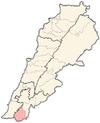
Chalaaboun
Chalaaboun[1] (Arabic: شلعبون) is an archeological site in the outskirts of Ain Ebel in South Lebanon.
History
[edit]Ernest Renan visited Chalaaboun during his mission to Lebanon and described what he found in his book Mission de Phénicie (1865-1874). Renan believed that Chalaaboun was the Biblical town of Shaalabbin of the Tribe of Dan.[2] He found a tomb similar to that of Jesus Christ.[3]
In 1875, Victor Guérin called for the "attention to the sarcophagi alluded to by Lieutenant Kitchener. He says there are two which have sculptured on the sides a winged figure holding up a garland to right and left, the curve of which is surmounted on one side by a disc, and on the other by a cross. Beside one lies the cross, furnished with a ridge and acroteria. To the west of this hill rises a second, the slopes of which are terraced, the highest platform being sustained by a strong wall. Here are the vestiges of a small town, in the shape of cisterns and foundations of cut stones.[4]
In 1881, the PEF's Survey of Western Palestine (SWP) described it: "Heaps of well-cut stones, some of large size ; four or five sarcophagi, very large and well-preserved, decorated with figures holding up a wreath, similar to those at Kades, but better preserved. There are also two caves and many cisterns, and a large birkeh on the south side. This was an ancient and important place.[5]
References
[edit]- ^ Kh. Shelabun: meaning "The ruin of Shelabun", where Shelabun was personal name, according to Palmer, 1881, p. 86
- ^ Minervini, Giulio. Bulletino archeologico italiano, Volumes 1-2, "Antichità Oritentali", Naples, Italy, 1862 pages 150-151
- ^ Renan, 1864, pp. 677-8
- ^ Guérin, 1880, pp. 110-111; as given in Conder and Kitchener, 1881, SWP I, p. 245
- ^ Conder and Kitchener, 1881, SWP I, p. 245
Bibliography
[edit]- Conder, C.R.; Kitchener, H.H. (1881). The Survey of Western Palestine: Memoirs of the Topography, Orography, Hydrography, and Archaeology. Vol. 1. London: Committee of the Palestine Exploration Fund.
- Guérin, V. (1880). Description Géographique Historique et Archéologique de la Palestine (in French). Vol. 3: Galilee, pt. 2. Paris: L'Imprimerie Nationale.
- Palmer, E.H. (1881). The Survey of Western Palestine: Arabic and English Name Lists Collected During the Survey by Lieutenants Conder and Kitchener, R. E. Transliterated and Explained by E.H. Palmer. Committee of the Palestine Exploration Fund.
- Renan, E. (1864). Mission de Phénicie (in French). Paris: Imprimerie impériale.
External links
[edit]- Survey of Western Palestine, Map 4: IAA, Wikimedia commons

