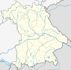
Cham (Oberpf) station
Appearance
| Bf | ||||||||||||||||||||||||||||||||||||||||
 2014 | ||||||||||||||||||||||||||||||||||||||||
| General information | ||||||||||||||||||||||||||||||||||||||||
| Location | Bahnhofstraße 11 93413 Cham Bavaria Germany | |||||||||||||||||||||||||||||||||||||||
| Coordinates | 49°13′19″N 12°39′25″E / 49.22188°N 12.65697°E | |||||||||||||||||||||||||||||||||||||||
| Elevation | 374 m (1,227 ft) | |||||||||||||||||||||||||||||||||||||||
| Owned by | Deutsche Bahn | |||||||||||||||||||||||||||||||||||||||
| Operated by | ||||||||||||||||||||||||||||||||||||||||
| Line(s) | ||||||||||||||||||||||||||||||||||||||||
| Platforms | 1 island platform 1 side platform | |||||||||||||||||||||||||||||||||||||||
| Tracks | 4 | |||||||||||||||||||||||||||||||||||||||
| Train operators | ||||||||||||||||||||||||||||||||||||||||
| Connections | ||||||||||||||||||||||||||||||||||||||||
| Construction | ||||||||||||||||||||||||||||||||||||||||
| Parking | yes | |||||||||||||||||||||||||||||||||||||||
| Bicycle facilities | yes | |||||||||||||||||||||||||||||||||||||||
| Accessible | partly | |||||||||||||||||||||||||||||||||||||||
| Other information | ||||||||||||||||||||||||||||||||||||||||
| Station code | 1037 | |||||||||||||||||||||||||||||||||||||||
| DS100 code | NCH[1] | |||||||||||||||||||||||||||||||||||||||
| IBNR | 8001330 | |||||||||||||||||||||||||||||||||||||||
| Category | 4[2] | |||||||||||||||||||||||||||||||||||||||
| Fare zone | VLC | |||||||||||||||||||||||||||||||||||||||
| Website | www.bahnhof.de | |||||||||||||||||||||||||||||||||||||||
| Services | ||||||||||||||||||||||||||||||||||||||||
| ||||||||||||||||||||||||||||||||||||||||
 | ||||||||||||||||||||||||||||||||||||||||
Cham (Oberpf) station is a railway station in the municipality of Cham, located in the Cham district in Bavaria, Germany. The station is located in the Upper Palatinate (Oberpfalz, abbreviated to "Oberpf" in the station's name) administrative district.
See also
[edit]References
[edit]- ^ Eisenbahnatlas Deutschland (German railway atlas) (2017 ed.). Schweers + Wall. 2017. ISBN 978-3-89494-146-8.
- ^ "Stationspreisliste 2025" [Station price list 2025] (PDF) (in German). DB Station&Service. 28 November 2024. Retrieved 5 December 2024.


