Città Sant'Angelo
Città Sant'Angelo | |
|---|---|
| Comune di Città Sant'Angelo | |
 | |
| Country | Italy |
| Region | Abruzzo |
| Province | Pescara (PE) |
| Frazioni | Alzano, Annunziata, Crocifisso, Fagnano, Fonte Umano, Gaglierani, Maddalena, Madonna della Pace, Marina, Piano della Cona, Piano di Sacco, Ponticelli, San Giacomo, San Martino, San Pietro, San Rocco, San Vittorino, Sant'Agnese, Sorricchio, Vertonica, Villa Cipressi |
| Government | |
| • Mayor | Gabriele Florindi |
| Area | |
• Total | 61 km2 (24 sq mi) |
| Elevation | 322 m (1,056 ft) |
| Population (31 December 2010)[2] | |
• Total | 14,553 |
| • Density | 240/km2 (620/sq mi) |
| Demonym | Angolani |
| Time zone | UTC+1 (CET) |
| • Summer (DST) | UTC+2 (CEST) |
| Postal code | 65013 |
| Dialing code | 085 |
| Patron saint | Saint Michael the Archangel |
| Website | Official website |
Città Sant'Angelo (Italian: [tʃitˈta sanˈtandʒelo]) is a town and comune in the province of Pescara, Abruzzo, Italy.
History
Located in the eastern portion of the Vestine region. Mentioned by Plinius as one of four Vestini cities, Angelus or Angulum, where today Città Sant'Angelo stands. It is cited from the 12th century as Castrum Sancti Angeli (Latin: "Castle of the Holy Angel").

It was a Guelph city destroyed in 1239 by Boemondo Pissono, executioner to Frederick II, Holy Roman Emperor of the Hohenstaufen dynasty, because the city was too loyal to his enemy, the Roman Catholic Church. Reconstruction began in 1240 and the city took the shape of a fortified nucleus in a semicircle. It gradually became one of several feudal possession, between the Carafa and the Piccolomini. The arrival of the monastic orders in the first half of the 14th century generated widening interest and finally a monastery was established. By 1528 it obtained the current name of the city. Gradually an agrarian bourgeoisie firmly established itself through to the 17th century.
At the turn of the 20th century, many people left the region and joined the mass migration to the Americas. Today, it is known for its historical architecture and as a tourist location that offers its own variety of wine and cuisine.
Main sights
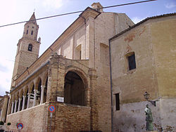
The Collegiate Church, originally from before the 11th century, was rebuilt in the 14th century. It has a 48-metre-tall (157 ft) bell tower and houses remains of an early medieval pulpit from the 7th-8th centuries, as well as a portico and the tomb of bishop Amico di Buonamicizia, both from the 15th century.
Other sights include the churches of St. Francis, St. Clare and St. Bernardo.
People
- Massimo Oddo, World Cup-winning footballer
- Ruggero Pasquarelli, actor in the Disney Channel original series Violetta
See also
References
- ^ "Superficie di Comuni Province e Regioni italiane al 9 ottobre 2011". Italian National Institute of Statistics. Retrieved 16 March 2019.
- ^ "Popolazione Residente al 1° Gennaio 2018". Italian National Institute of Statistics. Retrieved 16 March 2019.


