Coed-Ely
Appearance
Coed-Ely
| |
|---|---|
 Garth Street, Coed-Ely | |
Location within Rhondda Cynon Taf | |
| Principal area | |
| Preserved county | |
| Country | Wales |
| Sovereign state | United Kingdom |
| Police | South Wales |
| Fire | South Wales |
| Ambulance | Welsh |
| UK Parliament | |
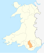
Coed-Ely is a small village located to the south of Tonyrefail in south Wales and is located in the County Borough of Rhondda Cynon Taf. The name Coed-Ely is a derivative of the Welsh words Coed-Elái which can be loosely translated into English as Ely Woods.


