
Copper Mountain, Colorado
Copper Mountain is a census-designated place (CDP) in Summit County, Colorado, United States.[1] Its elevation is 9,695 feet (2,955 m), and it is located at 39°30′24″N 106°8′32″W / 39.50667°N 106.14222°W.[2]
It is located approximately 20 miles (32 km) north-northeast of Leadville in the White River National Forest. It was originally named "Wheeler" for a local judge and developer, and it has also been known as "Wheeler Station" in the past. The naming question was settled by a decision from the Board on Geographic Names, which ruled in favor of "Copper Mountain" in 1977.[2]
See also
References
Wikivoyage has a travel guide for Copper Mountain.
Municipalities and communities of Summit County, Colorado, United States | ||
|---|---|---|
| Towns | 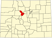 | |
| CDPs | ||
| Ghost towns |
| |
This Colorado state location article is a stub. You can help Wikipedia by expanding it. |