Curanipe
Appearance
You can help expand this article with text translated from the corresponding article in Spanish. (February 2010) Click [show] for important translation instructions.
|
Curanipe | |
|---|---|
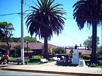
 Plaza de Curanipe | |
 | |
| Country | Chile |
| Region | Maule |
| Province | Cauquenes |
| Commune | Pelluhue |
| Named for | "Black stone" in Mapudungun |
| Elevation | 24 m (79 ft) |
| Time zone | UTC-4 |

Curanipe (in mapudungun: "plum tree that grows in the rock") is a town and seat of the municipality of Pelluhue, Province of Cauquenes, in VII Maule Region of Chile.
A popular and charming coastal resort, Curanipe used to be a well-known and secluded hangout for the Cauquenes elite and a proud regional "minor port", during the mid- and late 19th century. The town has a quaint architectural style that echoes the colonial rural architecture of Chile.
The Curanipe parish church of Santo Toribio, is a beautifully preserved religious building overlooking the town.
On 27 February 2010 at 06:34:14 GMT (03:34:14 AM local time), a magnitude 8.8 earthquake struck the seafloor 7 miles (11 km) southwest of Curanipe.[1]
References
- ^ USGS 8.8 Earthquake in Chile Archived 2010-03-02 at the Wayback Machine
