Dønna Municipality
Dønna Municipality
Dønna kommune | |
|---|---|
 | |
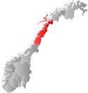
 Nordland within Norway | |
 Dønna within Nordland | |
| Country | Norway |
| County | Nordland |
| District | Helgeland |
| Administrative centre | Solfjellsjøen |
| Government | |
| • Mayor (2011) | Anne S. Mathisen (Ap) |
| Area | |
• Total | 193.90 km2 (74.87 sq mi) |
| • Land | 187.64 km2 (72.45 sq mi) |
| • Water | 6.26 km2 (2.42 sq mi) |
| • Rank | #330 in Norway |
| Population (2011) | |
• Total | 1,449 |
| • Rank | #365 in Norway |
| • Density | 7.7/km2 (20/sq mi) |
| • Change (10 years) | |
| Demonym | Dønnværing[1] |
| Official language | |
| • Norwegian form | Bokmål |
| Time zone | UTC+01:00 (CET) |
| • Summer (DST) | UTC+02:00 (CEST) |
| ISO 3166 code | NO-1827[3] |
| Website | Official website |
Dønna is an island and a municipality in Nordland county, Norway. It is part of the Helgeland region. The administrative centre of the island municipality is the village of Solfjellsjøen. Other villages include Bjørn, Dønnes, Hestad, Sandåker, and Vandve. The main island of Dønna is connected to Herøy to the south by the Åkviksundet Bridge.
General information


Municipal history
The municipality of Dønna was established on 1 January 1962 when the municipality of Nordvik (population: 1,293) was merged with the part of Herøy on the southern tip of the island of Dønna (population: 19), the part of Nesna on the island Løkta (population: 80), and most of Dønnes municipality (population: 1,348). The borders have not changed since that time.[4]
Name
The municipality is named after the island of Dønna (Old Norse Dyn). The name is probably derived from the Norse verb dynja which means to "rumble" or "roar" (referring to the swell of the waves on the island).[5]
Coat-of-arms
The coat-of-arms is from modern times; they were granted on 29 May 1981. The arms show a wave as a canting symbol for the municipality since the Norwegian word dønning means wave.[6]
Churches
The Church of Norway has one parish (sokn) within the municipality of Dønna. It is part of the Nord-Helgeland deanery in the Diocese of Sør-Hålogaland.
| Parish (Sokn) |
Church Name | Location of the Church |
Year Built |
|---|---|---|---|
| Dønna | Dønnes Church | Dønnes | 13th century |
| Hæstad Church | Hestad | 1912 | |
| Løkta Church | Sandåker | 1968 | |
| Nordvik Church | Nordvik | 1877 | |
| Vandve Church | Vandve | 1956 |
Economy
Much of the industry focuses on fishing, aquaculture, and fish processing. There is also some agriculture, tourism, and some public services.
Government
All municipalities in Norway, including Dønna, are responsible for primary education (through 10th grade), outpatient health services, senior citizen services, unemployment and other social services, zoning, economic development, and municipal roads. The municipality is governed by a municipal council of elected representatives, which in turn elect a mayor.
Municipal council
The municipal council (Kommunestyre) of Dønna is made up of 17 representatives that are elected to every four years. Currently, the party breakdown is as follows:[7]
| Party name (in Norwegian) | Number of representatives | |
|---|---|---|
| Labour Party (Arbeiderpartiet) | 6 | |
| Progress Party (Fremskrittspartiet) | 1 | |
| Conservative Party (Høyre) | 2 | |
| Socialist Left Party (Sosialistisk Venstreparti) | 3 | |
| Local List(s) (Lokale lister) | 5 | |
| Total number of members: | 17 | |
Geography
Dønna is located in Outer Helgeland which also consists of the municipalities of Leirfjord, Alstahaug, and Herøy. The municipality is made up of a large archipelago consisting of islands, islets, and reefs. The three largest islands in the municipality are Dønna, Løkta, and Vandve. The Åsværet islands (and the Åsvær Lighthouse) lie in the western part of the municipality. The island municipality is situated at the mouth of the Ranfjorden.
Notable residents
- Anton Christian Bang, theologian and author
- Steinar Bastesen, whaler and independent politician
- Petter Dass, priest and poet (birthplace disputed: could also be in present-day Herøy)
- Odd Eriksen, Labour politician
- Roy Jacobsen, author (born in Oslo, but has lived periodically on Dønna
- Frederikke Tønder Olsen, feminist pioneer
- Julius J. Olson, Minnesota Supreme Court justice
- Ole Edvart Rølvaag, Norwegian-American author
References
- ^ "Navn på steder og personer: Innbyggjarnamn" (in Norwegian). Språkrådet.
- ^ "Forskrift om målvedtak i kommunar og fylkeskommunar" (in Norwegian). Lovdata.no.
- ^ Bolstad, Erik; Thorsnæs, Geir, eds. (2023-01-26). "Kommunenummer". Store norske leksikon (in Norwegian). Kunnskapsforlaget.
- ^ Jukvam, Dag (1999). "Historisk oversikt over endringer i kommune- og fylkesinndelingen" (PDF) (in Norwegian). Statistisk sentralbyrå.
- ^ "Helgelands stedsnavn". Historisk tidsskrift (in Norwegian). Kristiania, Norge: Den Norske historiske forening: 70. 1871. Retrieved 2008-11-18.
- ^ Norske Kommunevåpen (1990). "Nye kommunevåbener i Norden". Retrieved 2008-11-20.
- ^ "Table: 04813: Members of the local councils, by party/electoral list at the Municipal Council election (M)" (in Norwegian). Statistics Norway. 2015.
External links
 Nordland travel guide from Wikivoyage
- Municipal fact sheet from Statistics Norway
- Photos from Dønna Template:De icon


