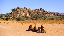
Djado Plateau
Appearance

The Djado Plateau lies in the Sahara, in northeastern Niger. It is known for its cave art (often of large mammals long since absent from the area), but is now largely uninhabited, with abandoned towns and forts still standing and visible. As of 2011, the commune of Djado had a total population of 1,488 people.[1]
World Heritage Status
This site was added to the UNESCO World Heritage Tentative List on May 26, 2006 in the Cultural category due to its universal cultural significance.
References
- ^ "Annuaires_Statistiques" (PDF). Institut National de la Statistique du Niger. Retrieved 2 May 2013.
