Draft:Chornoholova
| Submission declined on 9 December 2023 by BuySomeApples (talk). This submission is not adequately supported by reliable sources. Reliable sources are required so that information can be verified. If you need help with referencing, please see Referencing for beginners and Citing sources.
Where to get help
How to improve a draft
You can also browse Wikipedia:Featured articles and Wikipedia:Good articles to find examples of Wikipedia's best writing on topics similar to your proposed article. Improving your odds of a speedy review To improve your odds of a faster review, tag your draft with relevant WikiProject tags using the button below. This will let reviewers know a new draft has been submitted in their area of interest. For instance, if you wrote about a female astronomer, you would want to add the Biography, Astronomy, and Women scientists tags. Editor resources
|  |
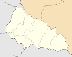
| Submission declined on 1 December 2023 by Zoglophie (talk). Add a map if possible. |  |
 Comment: Can you add some inline citations to the history section. BuySomeApples (talk) 22:42, 9 December 2023 (UTC)
Chornoholova
Чорноголо́ва | |
|---|---|
 Wooden church in Chornoholova. | |
| Coordinates: 48°51′03″N 22°36′25″E / 48.85083°N 22.60694°E | |
| Country | |
| Oblast | Zakarpattia Oblast |
| Raion | Uzhhorod Raion |
| Elevation | 291 m (955 ft) |
| Population (2001[1]) | |
| • Total | 1,348 |
Chornoholova (Ukrainian: Чорноголо́ва; Hungarian: Sóhát; Slovak: Černohlava) is a village in Zakarpattia Oblast, Ukraine. The village is primarily inhabited by the Lemko ethnic group.
History[edit]
The first mention of the village dates back to 1552. There are a few stories which claim to explain the village's name. One of them is about a rebel named Holovatyi who lived in a hut in the forest. His house was burned down by the army, and when people came to view his house, they saw a black burnt head on the ashes. The place was subsequently called Chornoholova (roughly translating to "black head"), and the village that appeared there was named after it.
Another tradition tells of a couple who ran into the forest because they could not get married. They made a campfire and fell asleep, but the fire spread and they were burned alive. Some travelers later stumbled upon the campgrounds, and saw two burnt heads.
Demographics[edit]
In 1989, the village had 1,581 residents.[2]
The linguistic makeup of the residents according to the 2001 census are as follows:
References[edit]
- ^ "Кількість наявного населення по кожному сільському населеному пункту, Закарпатська область (осіб) - Регіон , Рік (2001(05.12))". database.ukrcensus.gov.ua. Банк даних Державної служби статистики України. Archived from the original on 2014-07-31.
- ^ "Кількість наявного та постійного населення по кожному сільському населеному пункту, Закарпатська область (осіб) - Регіон, Рік, Категорія населення , Стать (1989(12.01))". database.ukrcensus.gov.ua. Банк даних Державної служби статистики України. Archived from the original on 2014-07-31.
- ^ "Розподіл населення за рідною мовою, Закарпатська область (у % до загальної чисельності населення) - Регіон, Рік , Вказали у якості рідної мову (2001(05.12))". database.ukrcensus.gov.ua. Банк даних Державної служби статистики України. Archived from the original on 2014-07-31.


