
Dubuque, Kansas
Dubuque, Kansas | |
|---|---|
 | |
 Dubuque  Dubuque | |
| Coordinates: 38°41′45″N 98°36′32″W / 38.69583°N 98.60889°W | |
| Country | United States |
| State | Kansas |
| County | Barton, Russell |
| Elevation | 1,883 ft (574 m) |
| Time zone | UTC-6 (CST) |
| • Summer (DST) | UTC-5 (CDT) |
| ZIP code | 67634 |
| Area code | 785 |
| GNIS ID | 484734[1] |
Dubuque is an unincorporated community in Barton and Russell Counties in the U.S. state of Kansas. It is approximately 10 miles (18 km) south of Dorrance.
History
Polish immigrants from Illinois, Indiana, and Wisconsin first settled the area after the American Civil War. They were soon followed by Volga Germans from Minnesota, Wisconsin, and Dubuque, Iowa. A rural post office named Dubuque opened in 1879, and the village was formally established in 1887. Devout Catholics, the local townsfolk built their first church in the early 1870s. They replaced it in 1901 with St. Catherine Catholic Church which still stands.[2] The post office closed in 1909.[3] By the 1920s, Dubuque had begun to lose its population and its business community. Today, all that remains is the Catholic church and a cemetery.[2]
Geography
Dubuque is located at 38°41′45″N 98°36′32″W / 38.69583°N 98.60889°W (38.6958442, -98.6089626) at an elevation of 1,883 feet (574 m).[1] It lies 7 miles (11 km) south of the Smoky Hill River in the Smoky Hills region of the Great Plains. Located on the Barton County-Russell County line, Dubuque is roughly 18 miles (29 km) southeast of Russell and 24 miles (39 km) north-northeast of Great Bend. It is approximately 11 miles (18 km) south of Interstate 70 and 13 miles (21 km) east of U.S. Route 281.
References
- ^ a b "US Board on Geographic Names". United States Geological Survey. 2007-10-25. Retrieved 2008-01-31.
- ^ a b "Homesteading in Russell County - Dubuque". Kansas Heritage Project. Fort Hays State University. Archived from the original on 2010-06-03. Retrieved 2010-08-18.
{{cite web}}: Unknown parameter|deadurl=ignored (|url-status=suggested) (help) - ^ "Post Offices in Kansas". Kansas State Historical Society. Retrieved 2010-08-18.
External links
Municipalities and communities of Barton County, Kansas, United States | ||
|---|---|---|
| Cities |  | |
| CDPs | ||
| Unincorporated communities | ||
| Townships | ||
| Footnotes | ‡This community also has portions in an adjacent county or counties. | |
Municipalities and communities of Russell County, Kansas, United States | ||
|---|---|---|
| Cities | 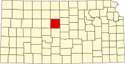 | |
| Unincorporated communities | ||
| Ghost towns | ||
| Townships | ||
| Footnotes | ‡This community also has portions in an adjacent county or counties. | |