
Durham, New Hampshire
Town of Durham | |
|---|---|
Town | |
 | |
 Seal | |
 Location within Strafford County, New Hampshire | |
| Country | United States |
| State | New Hampshire |
| County | Strafford |
| Settled | 1635 |
| Incorporated | 1732 |
| Government | |
| • Town Council | Neil Niman, Chair Douglas Clark Diana Carroll Gerald Needell Michael Sievert Robin Mower Julian Smith Peter Stanhope Karl Van Asselt |
| Area | |
| • Total | 24.8 sq mi (64.1 km2) |
| • Land | 22.4 sq mi (58.0 km2) |
| • Water | 2.4 sq mi (6.1 km2) 9.57% |
| Elevation | 50 ft (15 m) |
| Population (2007) | |
| • Total | 13,684 |
| • Density | 610.9/sq mi (235.9/km2) |
| Time zone | UTC-5 (EST) |
| • Summer (DST) | UTC-4 (EDT) |
| ZIP code | 03824 |
| Area code | 603 |
| FIPS code | 33-19700 |
| GNIS feature ID | 0873584 |
| Website | www.ci.durham.nh.us |
Durham is a town in Strafford County, New Hampshire, United States. The population was 12,664 at the 2000 census. Durham is home to the University of New Hampshire.
The primary settlement in town, where more than 71% of the population resides, is defined by the U.S. Census Bureau as the Durham census-designated place (CDP) and includes the densely-populated portion of the town centered on the intersection of New Hampshire Route 108 and Main Street and including the university which dominates the town.
History
Situated beside Great Bay at the mouth of the Oyster River, Durham was originally called Oyster River Plantation. It was settled in 1635 as a part of Dover.
During King William's War, on July 18, 1694, the English settlement was attacked in the "Oyster River Massacre" by French career soldier Sebastien de Villieu with about 250 Abenaki Indians from Norridgewock under command of their sagamore, Bomazeen (or Bomoseen). In all, 45 inhabitants were killed and 49 taken captive, with half the dwellings, including 5 garrisons, burned to the ground. Crops were destroyed and livestock killed, causing famine and destitution for survivors. The community would rebuild, however, and by 1716 Durham was a separate parish, named after Durham, England. Incorporated in 1732, Durham once included portions of the present-day towns of Madbury, Lee and Newmarket. Because of its arable land, the town would develop as a farming community.
A descendant of an early settler, Benjamin Thompson bequeathed his assets and family estate, Warner Farm, to the state for the establishment of an agricultural college. Originally founded in 1866, at Hanover, the New Hampshire College of Agriculture and the Mechanic Arts moved to Durham in 1893, and became University of New Hampshire in 1923. Thompson Hall, built in 1892 with an iconic clock tower, is named in his honor. Designed in the Romanesque Revival style by the Concord architectural firm of Dow & Randlett, it was listed on the National Register of Historic Places in 1996.
Police Department history
Until 1732, the town had a part-time constable who worked for Dover to collect "rates" (taxes). He was elected during town meeting, had the power to arrest and attach goods of delinquent taxpayers, and was expected to serve without pay unless excused from service. Fines, punishment, restoration of property, and payment of debts were matters handled by the constable with warrants issued by a local magistrate.
The first recording of the term "police officer" is found in a document dated in 1848. This entry was for the salary of Ezra Parson. Until the mid-1950s, the town budgeted a small stipend to pay special police officers. In the 1950s, a cooperative school district was formed and took over paying the salaries of the special officers.
During the 19th century, several references were made to a jail, though no specific location is known. Some references imply that the jail may also have served as General John Sullivan's law office or his slave quarters.
It was not until 1920 that the Town Report referred to a Police Department budget. Through the 1920s, the yearly operating budget for the department, including salaries, was $100.
Louis Bourgoin was appointed as the first Police Chief in August, 1928. His annual salary was $50. He served for 27 years.
The first full-time police officer was Benjamin J. Thomas, appointed in 1948. Thomas became Chief when Bourgoin retired.
Raymond I. Burrows was appointed as a police officer in 1959. Eight months later, he became Chief when Thomas died of a heart attack. Ray Burrows served as the Chief of Police until 1979, when he too suffered a heart attack. Lt. Paul Gowen was then elected to serve as Chief.
Until 1961, police officers worked out of their homes. No police officer was on duty after midnight. Residents needing police assistance called local businesses, hoping that an officer was nearby. In 1961, police headquarters was founded in the first floor of Town Hall. (This building now serves as the Durham District Court.)
Town Hall moved to the existing building on Newmarket Road in 1972, leaving the Police Department and District Court to share the old building. On February 20, 1979, the building's interior was gutted by fire, and the Police Department moved into temporary quarters in Town Hall.
In May, 1995, Chief Paul Gowen retired. On January 1, 1996, David L. Kurz was appointed as the Town's fifth Chief of Police.
After 19 years in "temporary" quarters, the Police Department moved from Town Hall into the present police station at 86 Dover Road and began operating from those quarters on April 11, 1997.
The present-day Durham Police Department is made up of 18 full-time, sworn-in police officers and provides service 24 hours a day.
Fire Department history
The Durham Fire Department is one of a small percentage of fire departments in the United States jointly funded by a municipality and major state university. This situation has been in practice for many decades and has worked to benefit both the Town of Durham and the University of New Hampshire. The funding ratio has varied throughout time starting out at 50/50, evolving to 66% University and 33% Town, back to 50/50 and finally to a three-year average of responses based upon location, presently 53% Town and 47% University.
In the early 1900s the Durham-University of New Hampshire Fire Department was entirely voluntary, with no real organization. When the fire alarm sounded, anyone so inclined would run to the shed at the rear of Thompson Hall on the University of New Hampshire campus where a hose reel was housed, and haul it to the vicinity of the fire. A hand-drawn trailer with a few ladders stacked on it and a hand-drawn chemical tub completed the make-up of the firefighting apparatus. Later, a Reo chemical truck replaced the hand-drawn tub, and an International truck was converted to a ladder truck by the Service Department of the University.
On April 1, 1927, thirteen civil-minded members of the community "recognizing the necessity for a properly drilled fire department for the University and Town hereby agree to become members of such a department", an organized fire department was born in Durham. Two companies were formed, a hose company and a ladder company, each with a captain and lieutenant and all men subject to the orders of an elected chief. These men agreed to serve for two years.
After the Town Meeting in March 1928, an agreement was entered into by the Town and the University, signed by the President of the University and the Board of Selectmen of Durham, approving the establishment of an organized voluntary fire department of two companies of ten men each and the paying jointly of all bills contracted by the department.
In 1931, the first customized piece of fire apparatus, a Seagrave pumper, was purchased and placed into service by the Durham-University of New Hampshire Fire Department. A major step forward was taken on May 7, 1934 when the first permanent firefighter, a man by the name of Ralph Manning, was hired. Mr. Manning had three years experience with the Franklin New Hampshire Fire Department and two years experience with the Nashua, New Hampshire Fire Department.
Durham’s first full-time Fire Chief, Carroll Nash, was hired on March 2, 1936. Effective as of September 1937, a set of "Regulations for the Durham-University of New Hampshire Fire Department" as drawn up by Harold Loveren and Edward Getchell, Board of Fire Engineers, was adopted.
Over the years, the fire apparatus has been housed in various buildings. As stated earlier, the hose reel and chemical hand-tub had been housed in a shed behind Thompson Hall. After World War I, the hose reel, Reo chemical truck and International ladder truck were housed in garages at the rear of DeMeritt Hall. The Army ROTC unit took over this space and the fire equipment was moved to an area located in the Dairy Barns. When this building burned in 1937, the fire equipment was moved to garage space adjacent to Hewitt Hall. In the Fall of 1937, work was started on a fire station located on Colovos Road and part of the Service Building.
In 1941, a Robinson city-service truck built in 1916 and originally used by the town of Reading, Massachusetts, replaced the International ladder truck. The cost of this truck was $300.00; half was paid by the Town and half by the University.
The second permanent firefighter was hired in 1942, and the use of college students as members of the department was discontinued. The Chief and the permanent firefighter were on duty twenty-four hours per day with one day off in seven. At the March 1944 Town meeting, a Board of Fire Commissioners was established. This board consisted of one man appointed by the Selectmen and one man appointed by the University, with these two to select a third member of the Commission.
Also in 1944, the Board of Fire Commissioners with approval from the Town and University increased the permanent force of the Durham-UNH Fire Department by one member to provide full twenty-four hour coverage and a schedule of hours known as the two-platoon system.
During the late 1940s and early 1950s, the fire department struggled to bring its equipment up to suitable standards. In 1944, a 1 ton 1938 Chevrolet was converted to a pumper truck carrying 487 gallons of water with a 90 gallon per minute pump. Oil delivery trucks were converted to fire apparatus, and in 1947 a U.S. Government surplus 500 gallon per minute pumper built and used during World War II was purchased from the Portsmouth Naval Shipyard and placed into service.
The State Fire Marshal conducted an evaluation of fire protection for the community in 1949. In his November 1, 1949 report to the Town and University the State Fire Marshal recommended that most of the existing fire apparatus be replaced with more reliable equipment especially the ladder truck. In 1953, the Robinson city-service truck (built in 1916) was retired and a seventy-five foot Seagrave aerial ladder truck was placed into service.
Another significant recommendation from the State Fire Marshal was for Durham and the University of New Hampshire to "provide an automatic electric fire alarm signal system with proper distribution of fire alarm boxes throughout the town and have the boxes on campus connected by auxiliary circuits to the recommended electric fire alarm signal systems within the building." Although not ever done, all University buildings are protected by an automatic electric fire alarm system as well as most significant buildings located in town.
There is not much recorded historical data on the Durham-UNH Fire Department through the 1960s. The 1970s brought about a lot of changes. The Durham-UNH Fire Department was reorganized into four bureaus to include Fire Prevention, Training, Suppression and Communications, with a captain in charge of each bureau. Emergency Medical Services started to play a significant role in fire department operations, and the department became known throughout the state of New Hampshire for its training innovations. In 1974, a "three platoon" shift system was implemented to reduce the workweek from 72 hours to 56 hours and to increase the on-duty shift staffing to four.
The 1980s brought tremendous turnover of personnel throughout the department. Over 50 permanent members including three fire chiefs came and went. This left the department in a constant state of turmoil. In 1984 the fire station was relocated to the southern end of the UNH Service Building on College Road, where it is located today.
In 1985, the position of fire chief was stabilized by the promotion of Robert P. Wood. The fire department changed to a "four platoon" system in 1986 to reduce the workweek from 56 hours to 42 hours. All department members were required to be Emergency Medical Technicians to improve the services provided to the community. In 1989 the administrative attachment of the fire department was transferred from the University of New Hampshire to the Town of Durham. The Board of Fire Commissioners was eliminated and a 50/50 funding ratio was implemented to reflect incident response.
The 1990s brought great progress and advancement to the Durham Fire Department. In 1991, spearheaded by the Durham Professional Firefighters Local 2253 and implemented by Chief Wood, Emergency Medical Advanced Life Support services were incorporated into the medical services provided by the department while the department adopted an incident command system for emergencies. New, state of the art high-pressure breathing apparatus and lighter weight firefighting clothing improved efficiency and firefighter safety. In 1998, the department created a long-range staffing plan and in 1999 added a full-time Training/Safety Captain to the staff.
The Durham Fire Department has recently completed a fifteen-year Strategic Plan and is conducting long-term planning for personnel, apparatus, training and facilities to meet the increasing demands of the community.
Geography
According to the United States Census Bureau, the town has a total area of 24.8 square miles (64 km2), of which 22.4 sq mi (58 km2) is land and 2.4 sq mi (6.2 km2) is water, comprising 9.57% of the town. The town is drained by the Oyster River. The highest point in Durham is Beech Hill, at 291 feet (89 m) above sea level, located on the town's northern border[1]. Durham lies fully within the Piscataqua River (coastal) watershed.[2]
The village area of the town, defined as a census-designated place (CDP), has a total area of 2.7 sq mi (7.0 km2), of which 0.1 sq mi (0.26 km2) (1.85%) is water.
Demographics

As of the census of 2000, there were 12,664 people, 2,882 households, and 1,582 families residing in the town. The population density was 565.5 people per square mile (218.4/km²). There were 2,923 housing units at an average density of 130.5/sq mi (50.4/km²). The racial makeup of the town was 94.55% White, 0.77% African American, 0.21% Native American, 3.10% Asian, 0.13% Pacific Islander, 0.27% from other races, and 0.97% from two or more races. 1.24% of the population were Hispanic or Latino of any race.
There were 2,882 households out of which 28.3% had children under the age of 18 living with them, 48.3% were married couples living together, 4.8% have a woman whose husband does not live with her, and 45.1% were non-families. 20.2% of all households were made up of individuals and 6.6% had someone living alone who was 65 years of age or older. The average household size was 2.79 and the average family size was 3.03.

The age distribution, heavily influenced by the presence of UNH, is: 12.0% under the age of 18, 56.5% from 18 to 24, 13.3% from 25 to 44, 12.1% from 45 to 64, and 6.1% who were 65 years of age or older. The median age was 21 years, which is also typical for a college town. For every 100 females there are 82.3 males. For every 100 females age 18 and over, there were 79.9 males.
The median income for a household in the town was $51,697, and the median income for a family was $83,609. Males had a median income of $54,519 versus $31,548 for females. The per capita income for the town was $17,210. 27.7% of the population and 2.8% of families were below the poverty line. Out of the total people living in poverty, 5.5% are under the age of 18 and 1.1% are 65 or older.
Town center
As of the census of 2000, there were 9,024 people, 1,703 households, and 727 families residing in the town center, or CDP. The population density was 3,398.7 people per square mile (1,309.8/km²). There were 1,718 housing units at an average density of 249.4 persons/km² (647.1 persons/sq mi). The racial makeup of the town was 93.27% White, 0.83% African American, 0.29% Native American, 3.96% Asian, 0.18% Pacific Islander, 0.32% from other races, and 1.15% from two or more races. 1.31% of the population were Hispanic or Latino of any race.
There were 1,703 households out of which 20.9% had children under the age of 18 living with them, 37.2% were married couples living together, 4.2% have a woman whose husband does not live with her, and 57.3% were non-families. 25.2% of all households were made up of individuals and 8.8% had someone living alone who was 65 years of age or older. The average household size was 2.59 and the average family size was 2.91.
The age distribution of the village area is: 6.8% under the age of 18, 71.5% from 18 to 24, 9.4% from 25 to 44, 7.1% from 45 to 64, and 5.2% who were 65 years of age or older. The median age was 21 years. The distribution and median age are both typical for university towns. For every 100 females there are 79.0 males. For every 100 females age 18 and over, there were 77.1 males.
The median income for a household is $30,040, and the median income for a family was $70,066. Males had a median income of $48,155 versus $26,250 for females. The per capita income for the town was $12,088. 39.9% of the population and 5.9% of families were below the poverty line. Out of the total people living in poverty, 12.3% are under the age of 18 and 1.8% are 65 or older. However, much of the population "living in poverty" consists of students, many of whom are still partially supported by their parents.
Notable inhabitants
- Daniel Ford, writer
- Joyce Maynard, writer
- Hercules Mooney, Revolutionary War officer
- Don Murray, journalist
- Deron Quint, NHL player
- Alexander Scammel, Col. of the 3rd New Hampshire Regiment
- Daniel C. Stillson [1] (1830-1899), inventor of the Stillson pipe wrench
- John Sullivan, Revolutionary War general
- Benjamin Thompson, farmer, businessman & benefactor of U.N.H.
Sites of Interest
See also
Photo gallery
-
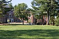
 Pettee Hall
 -
 Taylor Hall
 -
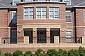
 Murkland Hall
 -
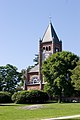 Thompson Hall
 -
 Dimond Library
 -
 Church
 -
 Downtown at Madbury Road and Main Street
 -
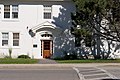
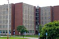 Babcock Hall


References
- ^ U.S. Geological Survey. Dover Quadrangle, New Hampshire-Maine map. 1:62,500. 15 Minute Series (Topographic). Washington D.C.: USGS, 1956. Available from University of New Hampshire Dimond Library Documents Department & Data Center, http://docs.unh.edu/NH/dovr56sw.jpg accessed 2009-03-17.
- ^ Foster, Debra H. (1995). Water Use in New Hampshire: An Activities Guide for Teachers. U.S. Department of the Interior and U.S. Geological Survey.
{{cite book}}: Unknown parameter|coauthors=ignored (|author=suggested) (help)
External links
- Town website
- New Hampshire Economic and Labor Market Information Bureau Profile
- University of New Hampshire
- History of the Oyster River Massacre
- Oyster River Community Blog
Municipalities and communities of Strafford County, New Hampshire, United States | ||
|---|---|---|
| Cities |  | |
| Towns | ||
| CDPs | ||
| Other villages | ||