Eastern Venezuela Basin
Appearance

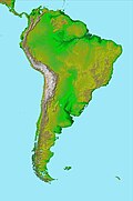
The Eastern Venezuela Basin is major sedimentary basin in northeastern Venezuela that contains copious petroleum reserves. The basin lies between several geological structures. To the south it bounds Guiana Shield, to the north metamorphic rocks of the easternmost Andes, to the west the Espino Graben, to the northeast the Barbados accretionary complex and to the east it bounds to the oceanic crust of the Atlantic Ocean.[1]
References
- ^ Summa, L.L.; Goodman, E.D.; Richardson, M.; Norton, I.O.; Green, A.R. (2003). "Hydrocarbon systems of Northeastern Venezuela: plate through molecular scale-analysis of the genesis and evolution of the Eastern Venezuela Basin". Marine and Petroleum Geology. 20 (3–4). Elsevier: 323–349. doi:10.1016/s0264-8172(03)00040-0. Retrieved 12 December 2015.

