Egeria, West Virginia
Egeria, West Virginia | |
|---|---|
| Coordinates: 37°32′21″N 81°12′00″W / 37.53917°N 81.20000°W | |
| Country | United States |
| State | West Virginia |
| Counties | Mercer and Raleigh |
| Elevation | 2,972 ft (906 m) |
| Time zone | UTC-5 (Eastern (EST)) |
| • Summer (DST) | UTC-4 (EDT) |
| Area code(s) | 304 & 681 |
| GNIS feature ID | 1549668[1] |

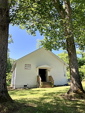
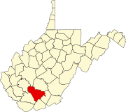
Egeria is an unincorporated community in Mercer and Raleigh counties, West Virginia, United States. Egeria is 8.5 miles (13.7 km) north-northeast of Matoaka. The 1881 guide to the Chesapeake and Ohio Railway lists a blacksmith, two cabinetmakers or undertakers, a general store, a machinist, corn or flour mill, sawmill, and nine "principal farmers".[2]
The community had a post office as of 1955.[3] The Egeria high school, which was built in 1913, was the last single-teacher high school in West Virginia. It had 21 total students at its peak, and enrollment numbers were usually in the teens, making it the smallest school in the county; in 1954 it had only two graduates.[4][5] At the time, the community was cut off from surrounding towns by poor-quality roads, which slowed local progress and led younger residents to move away.[6]
References
[edit]- ^ U.S. Geological Survey Geographic Names Information System: Egeria, West Virginia
- ^ Chataigne, J. H., ed. (1881). Chesapeake & Ohio Railway Directory, Containing an Illustrated History and Description of the Road, Together With Improvements and Connections Already Completed and those in Contemplation; …. Chesapeake & Ohio Railway. Retrieved July 18, 2022.
- ^ "Roads, Crop Production Topics for Egeria Meeting". The Raleigh Register. November 9, 1955. p. 5. Retrieved July 30, 2022 – via Newspapers.com.
- ^ "Egeria, A Teacher's Training Ground, Is Last One-Teacher High In State". Beckley Post-Herald. August 26, 1950. p. 8. Retrieved July 30, 2022 – via Newspapers.com.
- ^ Riffe, Audrey (May 22, 1952). "Little Egeria High Gets Big-Time Attention". The Raleigh Register. p. 16. Retrieved July 30, 2022 – via Newspapers.com.
- ^ "Community Just 27 Miles from Beckley But Poor Roads Practically Isolate It". The Raleigh Register. September 30, 1954. p. 21. Retrieved July 30, 2022 – via Newspapers.com.


