Ponta do Sinó Lighthouse
 Farol da Ponta do Sinó | |
 | |
| Location | Santa Maria Sal Cape Verde |
|---|---|
| Coordinates | 16°35′20.37″N 22°55′17.39″W / 16.5889917°N 22.9214972°W |
| Tower | |
| Constructed | 1892 (first) 2014 (second) |
| Foundation | concrete base |
| Construction | concrete tower |
| Height | 9 metres (30 ft)[1] |
| Shape | square tower with light atop and external staircase |
| Markings | white tower |
| Power source | solar power |
| Light | |
| First lit | 2004 |
| Deactivated | 2014 (first, now in ruins) |
| Focal height | 11 metres (36 ft)[1] |
| Light source | solar power |
| Range | 8 nautical miles (15 km; 9.2 mi)[1] |
| Characteristic | Fl (2+1) W 15s. [1] |
| Cape Verde no. | PT-2084[2] |
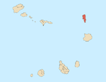
Farol da Ponta do Sinó (the Farol da Ponta do Sinó Lighthouse), is a lighthouse in the southernmost point of the island of Sal in northeastern Cape Verde, it is located 80 meters north of Ponta do Sinó and around 2 km southwest of the center of Santa Maria.[4] Until 2003, the area featured nothing but small bushes and dirt roads, in the early 2010s, new hotels and villas (the nearest being Hotel Funana (titled as Riu Funana, the Creole form, the name is African etymology named after the music genre) popped up north of the lighthouse and its communal limits spread to include the lighthouse and the whole portion, another one, Vila do Farol and its theater are named after the lighthouse.
History
The tower is quadrangular and is 9 meters tall and is made out of concrete, it has an outer staircase and features a lantern. All of the exterior are painted in white.[5]
The lighthouse was built and completed in 1892 by the Portuguese colonial government and was located more than 400 meters from the sea.
After the lighthouse was completed up to 1916, ship traffic was at its busiest as ships headed to and from Porto Grande Bay in São Vicente and accessed with other African ports in the tropics and the south and Australia, very few ships passed through the lighthouse. Today ships passed by the lighthouse at night are those that are domestic and cargo transport shipped to the island, these are being the busiest today.
In its early years, the lighthouse exterior colour was plain white and had a bottom rim. In the late 20th century, the bottom part faded and brick material what would compose and its exterior became light stucco. In early 2013, its second building with the same style was constructed and was finished before 2014 and became activated as the lighthouse moved to its new location. The older lighthouse became deactivated and a crack was formed east of the mid-staircase. In 2015, a new series of resort villas started construction east of the lighthouse and is near completion. No resorts have been constructed on the west side of the old lighthouse's location.
About the lighthouse
- Usage today: Active to navigation
- Access: a small road, section remaining a dirt road becoming paved, linked with a road connecting through Hotel Riu Funana.
- Public use: Area open, lighthouse closed (newer one uncertain)
See also
References
- ^ a b c d List of Lights, Pub. 113: The West Coasts of Europe and Africa, the Mediterranean Sea, Black Sea and Azovskoye More (Sea of Azov) (PDF). List of Lights. United States National Geospatial-Intelligence Agency. 2015.
- ^ a b c "Cape Verde". The Lighthouse Directory. University of North Carolina at Chapel Hill. Retrieved 17 April 2017.
- ^ "Ponta Norte". Lighthouses in Cape Verde. Direcção Geral da Marinha e Portos (DGMP). Archived from the original on May 31, 2010. Retrieved September 11, 2010.
{{cite web}}: Unknown parameter|deadurl=ignored (|url-status=suggested) (help) - ^ "ARLHS World List of Lights (WLOL)". Amateur Radio Lighthouse Society. 8 April 2009. Retrieved 13 April 2009.
- ^ "Ponta Norte (Reguinho Fiúra)". University of North Carolina at Chapel Hill The Lighthouse Directory. 2 September 2005. Retrieved 25 February 2016.
Notes
- Russ Rowlett (2 September 2005). "Pedra de Lume Second Range Near". The Lighthouse Directory. UNC at Chapel Hill. Retrieved 25 February 2016.

