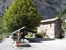
Faucon-du-Caire
Appearance
You can help expand this article with text translated from the corresponding article in French. (December 2008) Click [show] for important translation instructions.
|
Faucon-du-Caire | |
|---|---|
 A view within the village of Faucon-du-Caire, in 2007 | |
| Country | France |
| Region | Provence-Alpes-Côte d'Azur |
| Department | Alpes-de-Haute-Provence |
| Arrondissement | Forcalquier |
| Canton | Turriers |
| Government | |
| • Mayor (2008–2014) | Arthur Richier |
Area 1 | 19.93 km2 (7.70 sq mi) |
| Population (2008) | 55 |
| • Density | 2.8/km2 (7.1/sq mi) |
| Time zone | UTC+01:00 (CET) |
| • Summer (DST) | UTC+02:00 (CEST) |
| INSEE/Postal code | 04085 /04250 |
| Elevation | 846–1,714 m (2,776–5,623 ft) (avg. 910 m or 2,990 ft) |
| 1 French Land Register data, which excludes lakes, ponds, glaciers > 1 km2 (0.386 sq mi or 247 acres) and river estuaries. | |
Faucon-du-Caire is a commune in the Alpes-de-Haute-Provence department in southeastern France.
Population
| Year | Pop. | ±% |
|---|---|---|
| 1765 | 181 | — |
| 1793 | 136 | −24.9% |
| 1800 | 174 | +27.9% |
| 1806 | 158 | −9.2% |
| 1821 | 188 | +19.0% |
| 1831 | 199 | +5.9% |
| 1836 | 218 | +9.5% |
| 1841 | 221 | +1.4% |
| 1846 | 223 | +0.9% |
| 1851 | 221 | −0.9% |
| 1856 | 194 | −12.2% |
| 1861 | 187 | −3.6% |
| 1866 | 164 | −12.3% |
| 1872 | 160 | −2.4% |
| 1876 | 155 | −3.1% |
| 1881 | 160 | +3.2% |
| 1886 | 146 | −8.8% |
| 1891 | 147 | +0.7% |
| 1896 | 109 | −25.9% |
| 1901 | 106 | −2.8% |
| 1906 | 97 | −8.5% |
| 1911 | 93 | −4.1% |
| 1921 | 55 | −40.9% |
| 1926 | 55 | +0.0% |
| 1931 | 53 | −3.6% |
| 1936 | 48 | −9.4% |
| 1946 | 43 | −10.4% |
| 1954 | 49 | +14.0% |
| 1962 | 37 | −24.5% |
| 1968 | 38 | +2.7% |
| 1975 | 34 | −10.5% |
| 1982 | 35 | +2.9% |
| 1990 | 49 | +40.0% |
| 1999 | 35 | −28.6% |
| 2008 | 55 | +57.1% |
See also
References
Wikimedia Commons has media related to Faucon-du-Caire.


