Floyd Hill, Colorado
Appearance

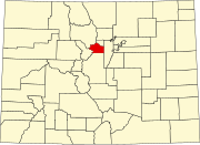
Floyd Hill is a census-designated place (CDP) in Clear Creek County, Colorado, United States. The population as of the 2010 Census was 998.[1]
See also
- Outline of Colorado
- State of Colorado
References
- ^ Colorado Trend Report 2: State and Complete Places (Sub-state 2010 Census Data). Missouri Census Data Center. Accessed 2011-02-25.
39°43′30″N 105°26′04″W / 39.72500°N 105.43444°W

