Fort Pierre Chouteau
Appearance
Fort Pierre Chouteau Site | |
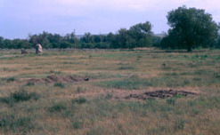
 Fields at the site | |
| Nearest city | Fort Pierre, South Dakota |
|---|---|
| Coordinates | 44°23′21″N 100°23′28″W / 44.38917°N 100.39111°W |
| NRHP reference No. | 76001756[1] |
| Significant dates | |
| Added to NRHP | April 3, 1976[2] |
| Designated NHL | July 17, 1991[1] |
Fort Pierre Chouteau Site is an archaeological site in Stanley County, South Dakota, near Fort Pierre, South Dakota. It was declared a National Historic Landmark in 1991.[1][3]
At the time of the designation in 1991, it was stated:
Perhaps the most significant fur trade/military fort on the western American frontier, Fort Pierre Chouteau was the largest (almost 300' square) and best equipped trading post in the northern Great Plains. Built in 1832 by John Jacob Astor's (1763-1848) American Fur Company as part of its expansion into the Upper Missouri region, the trading activities at the site exemplified the commercial alliance critical to the success of the fur business.[1]
References
- ^ a b c d "Fort Pierre Chouteau Site". National Historic Landmark summary listing. National Park Service. Retrieved 2008-06-14.
- ^ "National Register Information System". National Register of Historic Places. National Park Service. April 15, 2008.
- ^ "National Register of Historic Places Inventory-Nomination". National Park Service. December 1990.
External links

