This is an old revision of this page, as edited by WOSlinker(talk | contribs) at 12:14, 30 December 2017(tidy center tags for better HTML5 compatibility). The present address (URL) is a permanent link to this revision, which may differ significantly from the current revision.
Revision as of 12:14, 30 December 2017 by WOSlinker(talk | contribs)(tidy center tags for better HTML5 compatibility)
In November 1907 Line 5 was extended from Gare d'Orléans (now known as Gare d'Austerlitz) to Gare du Nord where the station was built on a reversing loop. On 21 April 1908 Line 4 was opened from Châtelet to Porte de Clignancourt through Gare du Nord. In 1942, the old Line 5 station was closed and replaced with a through station, in preparation for the extension to Église de Pantin. The part of the old loop that was not destroyed during the building of RER Line B in the 1970s together with connecting lines to Lines 2 and 4 under the Boulevard de Magenta and the Rue de Dunkerque are now used for driver training (USFRT). The length of platforms on Line 4 were extended from 75m to 90m in the 1960s during the upgrading of the line for rubber-tyre operations.


.png)
 Street-level entrance to Gare du Nord
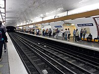 Line 5 platforms at Gare du Nord
 MF 67 rolling stock on Line 5 at Gare du Nord
 Platform signage


