Garminge
Appearance
Garminge | |
|---|---|
Town | |
 | |
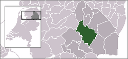
 Garminge in the municipality of Midden-Drenthe. | |
| Coordinates: 52°49′13″N 6°37′24″E / 52.82028°N 6.62333°E | |
| Country | Netherlands |
| Province | Drenthe |
| Municipality | Midden-Drenthe |
| Population (1 January 2005) | |
• Total | 70 |
| Time zone | UTC+1 (CET) |
| • Summer (DST) | UTC+2 (CEST) |
| Postal code | 9438 |
| Dialing code | 0593 |
Garminge is a town in the Dutch province of Drenthe. It is a part of the municipality of Midden-Drenthe, and lies about 15 km northeast of Hoogeveen.
The statistical area "Garminge", which can also include the surrounding countryside, has a population of around 70.[1]
The origin of the name Garminge is said to be from one of the first inhabitants. The name probably means farm owned by Garm, where the suffix -inge expresses possession, not necessarily that of a farm building. Garm is an old Dutch first name generally just used in the northern provinces Drenthe, Groningen and Frisia.
References
- ^ Statistics Netherlands (CBS), Statline: Kerncijfers wijken en buurten 2003-2005. As of 1 January 2005.
