Garyp
Appearance
Garyp
Garijp | |
|---|---|
Village | |
 St Peter's Church | |
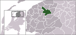
 Location of the village in Tytsjerksteradiel | |
| Coordinates: 53°9′59″N 5°58′12″E / 53.16639°N 5.97000°E | |
| Country | |
| Province | |
| Municipality | |
| Population (1 January 2017) | |
| • Total | 1,894 |
| Time zone | UTC+1 (CET) |
| • Summer (DST) | UTC+2 (CEST) |
| Postal code | 9263 |
| Dialing code | 0511 |
Garyp (Dutch: Garijp) is a village in Tytsjerksteradiel municipality in the province of Friesland, the Netherlands. It had a population of around 1,894 in January 2017.[1]
References
- ^ Overzicht inwonersaantal Tytsjerksteradiel - Tytsjerksteradiel


