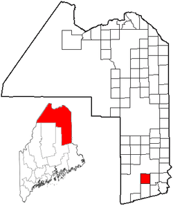
Glenwood Plantation, Maine
Appearance

Glenwood Plantation is a plantation located in Aroostook County, Maine, United States. At the 2010 census, the plantation had a total population of 3.[1]
Geography
According to the United States Census Bureau, the plantation has a total area of 39.5 square miles (102.4 km2), of which 38.1 square miles (98.8 km2) is land and 1.4 square miles (3.6 km2), or 3.48%, is water.[1]
Demographics
| Census | Pop. | Note | %± |
|---|---|---|---|
| 1870 | 185 | — | |
| 1880 | 198 | 7.0% | |
| 1890 | 183 | −7.6% | |
| 1900 | 178 | −2.7% | |
| 1910 | 128 | −28.1% | |
| 1920 | 87 | −32.0% | |
| 1930 | 77 | −11.5% | |
| 1940 | 75 | −2.6% | |
| 1950 | 53 | −29.3% | |
| 1960 | 30 | −43.4% | |
| 1970 | 9 | −70.0% | |
| 1980 | 7 | −22.2% | |
| 1990 | 8 | 14.3% | |
| 2010 | 3 | — | |
| 2014 (est.) | 3 | [2] | 0.0% |
At the 2010 Census, there were three people living in the plantation.[1]
References
- ^ a b c "Geographic Identifiers: 2010 Demographic Profile Data (G001): Glenwood plantation, Aroostook County, Maine". U.S. Census Bureau, American Factfinder. Retrieved May 21, 2013.
- ^ "Annual Estimates of the Resident Population for Incorporated Places: April 1, 2010 to July 1, 2014". Retrieved June 4, 2015.
- ^ "Census of Population and Housing". Census.gov. Archived from the original on May 11, 2015. Retrieved June 4, 2015.
{{cite web}}: Unknown parameter|deadurl=ignored (|url-status=suggested) (help)

