
Golden Grove, South Carolina
Golden Grove, South Carolina | |
|---|---|
 Location of Golden Grove, South Carolina | |
| Country | United States |
| State | South Carolina |
| County | Greenville |
| Area | |
| • Total | 5.8 sq mi (15.1 km2) |
| • Land | 5.8 sq mi (15.1 km2) |
| • Water | 0.0 sq mi (0.0 km2) |
| Elevation | 876 ft (267 m) |
| Population (2000) | |
| • Total | 2,348 |
| • Density | 402.0/sq mi (155.2/km2) |
| Time zone | UTC-5 (Eastern (EST)) |
| • Summer (DST) | UTC-4 (EDT) |
| FIPS code | 45-29635[1] |
| GNIS feature ID | 1231328[2] |
Golden Grove is a census-designated place (CDP) in Greenville County, South Carolina, United States. The population was 2,348 at the 2000 census. It is part of the Greenville–Mauldin–Easley Metropolitan Statistical Area.
Geography
Golden Grove is located at 34°43′50″N 82°26′20″W / 34.730689°N 82.439009°W.[3]
According to the United States Census Bureau, the CDP has a total area of 5.8 square miles (15 km2), all land.
Demographics
As of the census[1] of 2000, there were 2,348 people, 914 households, and 687 families residing in the CDP. The population density was 402.0 people per square mile (155.2/km2). There were 977 housing units at an average density of 167.3/sq mi (64.6/km2). The racial makeup of the CDP was 82.07% White, 15.93% African American, 0.09% Native American, 0.60% Asian, 0.09% Pacific Islander, 0.17% from other races, and 1.06% from two or more races. Hispanic or Latino of any race were 0.77% of the population.
There were 914 households out of which 33.3% had children under the age of 18 living with them, 58.9% were married couples living together, 12.4% had a female householder with no husband present, and 24.8% were non-families. 20.7% of all households were made up of individuals and 7.2% had someone living alone who was 65 years of age or older. The average household size was 2.57 and the average family size was 2.96.
In the CDP the population was spread out with 25.2% under the age of 18, 7.5% from 18 to 24, 31.2% from 25 to 44, 23.9% from 45 to 64, and 12.2% who were 65 years of age or older. The median age was 37 years. For every 100 females there were 93.4 males. For every 100 females age 18 and over, there were 88.6 males.
The median income for a household in the CDP was $41,447, and the median income for a family was $50,670. Males had a median income of $32,286 versus $24,451 for females. The per capita income for the CDP was $17,737. About 6.0% of families and 8.0% of the population were below the poverty line, including 8.1% of those under age 18 and 15.6% of those age 65 or over.
References
- ^ a b "American FactFinder". United States Census Bureau. Retrieved 2008-01-31.
- ^ "US Board on Geographic Names". United States Geological Survey. 2007-10-25. Retrieved 2008-01-31.
- ^ "US Gazetteer files: 2010, 2000, and 1990". United States Census Bureau. 2011-02-12. Retrieved 2011-04-23.
Municipalities and communities of Greenville County, South Carolina, United States | ||
|---|---|---|
| Cities | 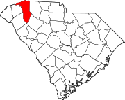 | |
| CDPs | ||
| Other communities | ||
| Footnotes | ‡This populated place also has portions in an adjacent county or counties | |